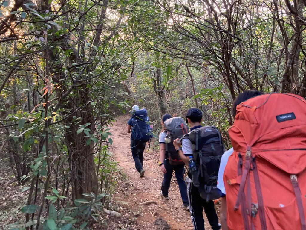
Jasper & BFFs – Lantau Island Hike (AYP Gold Level Adventurous Journey Section – Assessment Journey)
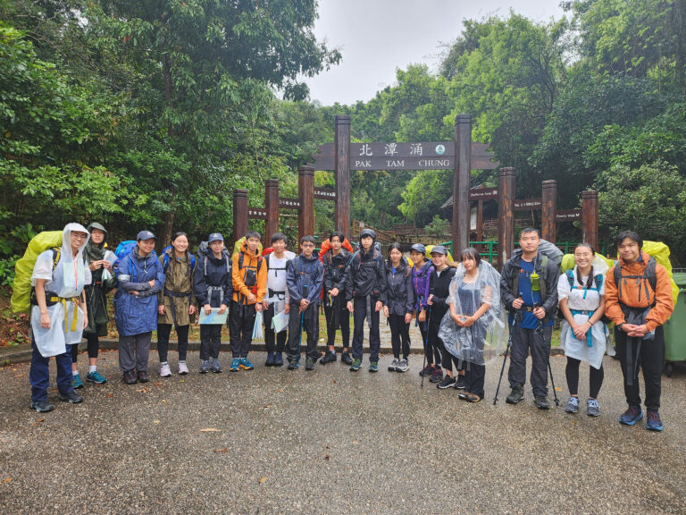
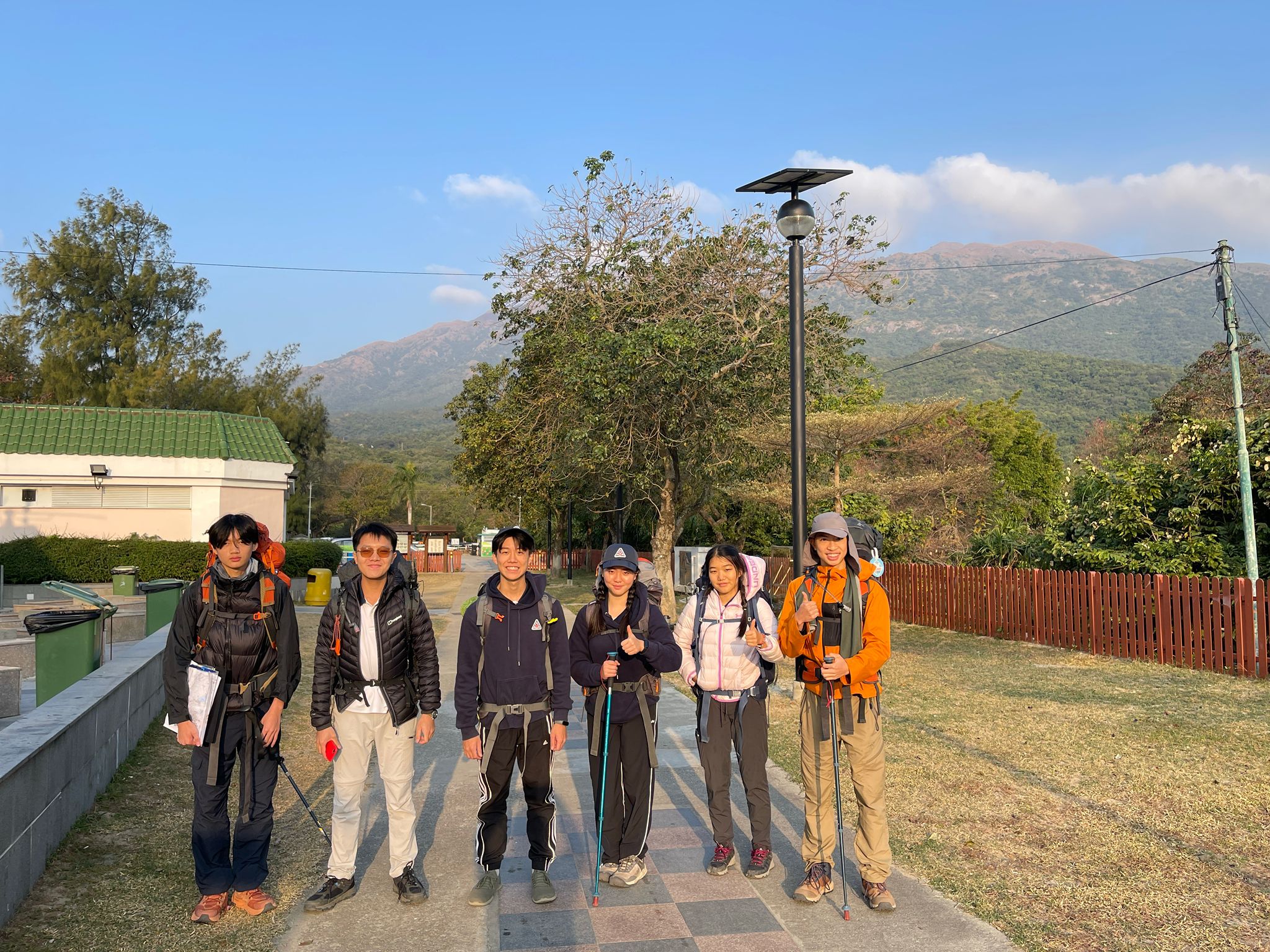
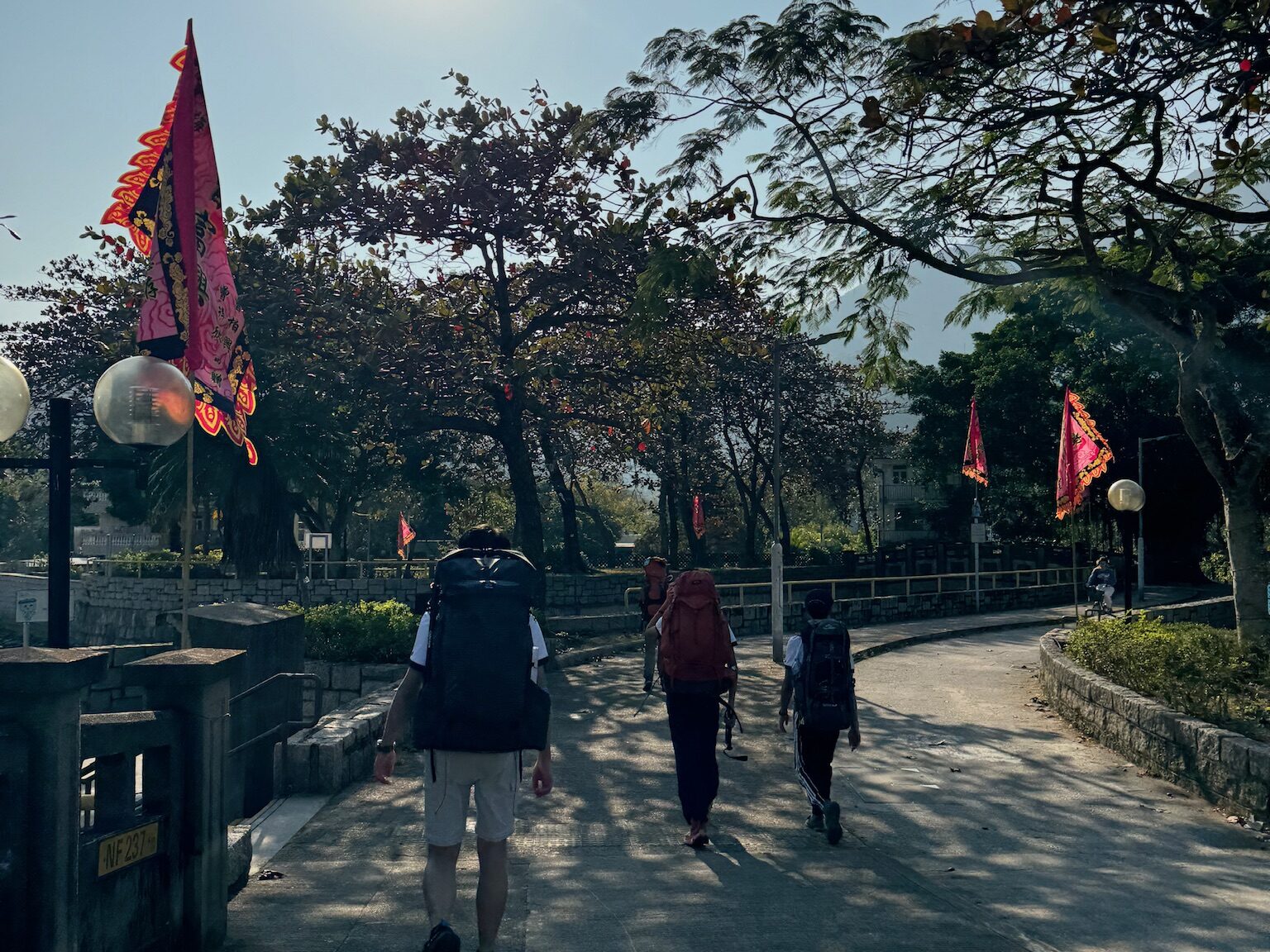
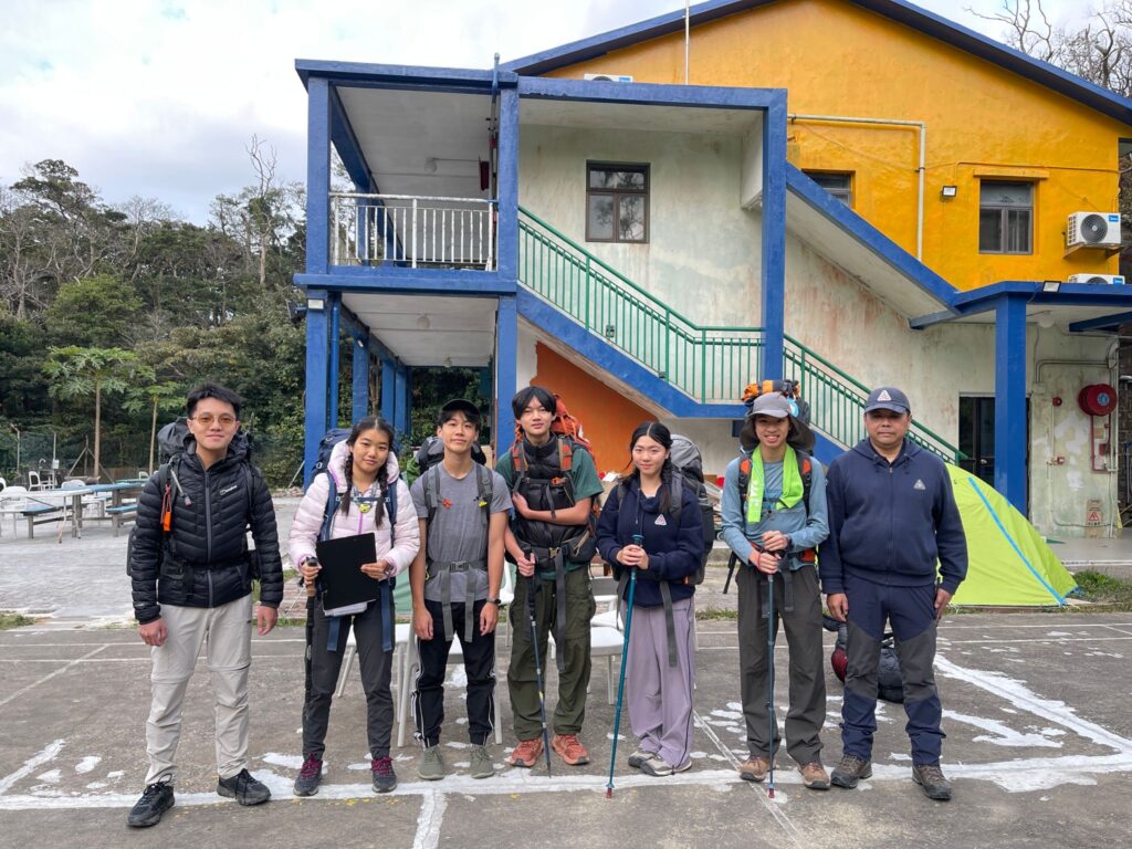
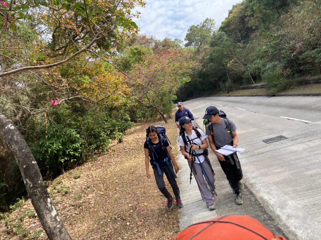
Lantau Island is one of the best locations in Hong Kong for hiking. It contains one of the tallest mountains in Hong Kong, Lantau Peak, and the number of country trails that are present in this island are plentiful enough for us to hike for a few days. On January 3-6, 2025, our team Jasper & Best Friends Forever, with Jasper, Brianna, Nicole, Ethan A, Ethan C, and Hermann, decide to go on our own little adventure and hike for 4 days around the entire island. This is our journey, and we do encourage you to try it out!
In this blog, we have included the description of the trail sections that we hiked upon, as well as any precautions and conservation tips that you should be aware of along the way. We have also included key landmarks that you will see if you follow our trail, as well as our observations and tips on improvement. We hope you do enjoy reading our blog. If you are more of a visual person, we also have a video which you can watch down below.
Video
Plans
The planned route for our journey was largely a clockwise path around Lantau Island, starting and ending at Tung Chung. On the first day, we followed the North Lantau Highway to Pak Mong and then made our way to Mui Wo. After passing through Ma Po Tsuen, we took the old Nam Shan Path to go past South Lantau Road and reached Shap Long Kau Tsuen. After that, it was a straightforward path to the Pui O campsite.
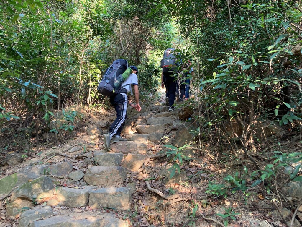
Days 1, 3, and 4 were relatively flat, covering approximately 17 km each, while Day 2 was shorter at 10 km but included more elevation changes, with a total of 1600 m uphill. In total, the distance of the hike was 62 km, which included 5,900 m of elevation gain and loss. Based on the speed from our practice trip, we estimated that the total hiking time would be just under 26 hours. However, due to the heavier equipment and increased food weight in winter, the actual hiking time likely ended up being about 10% longer.
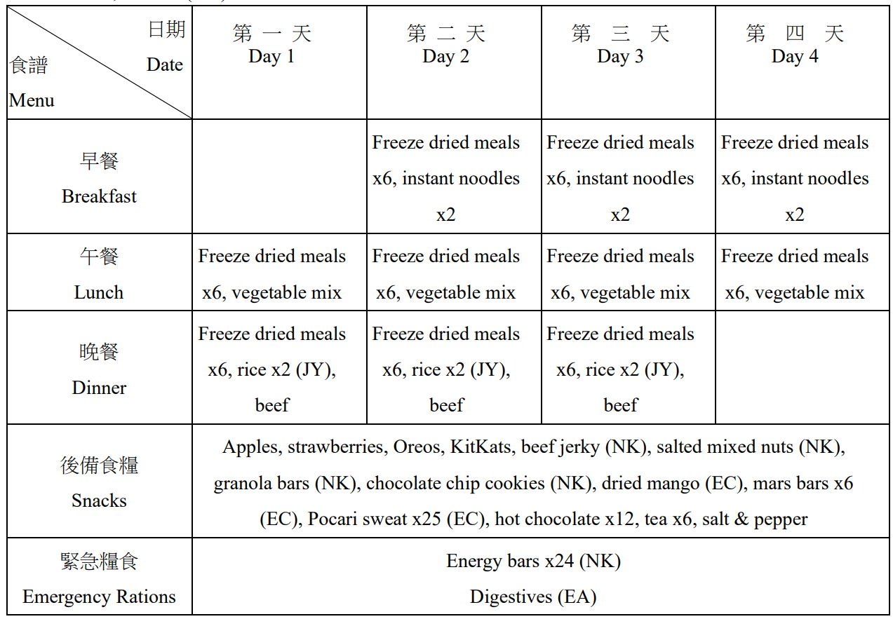
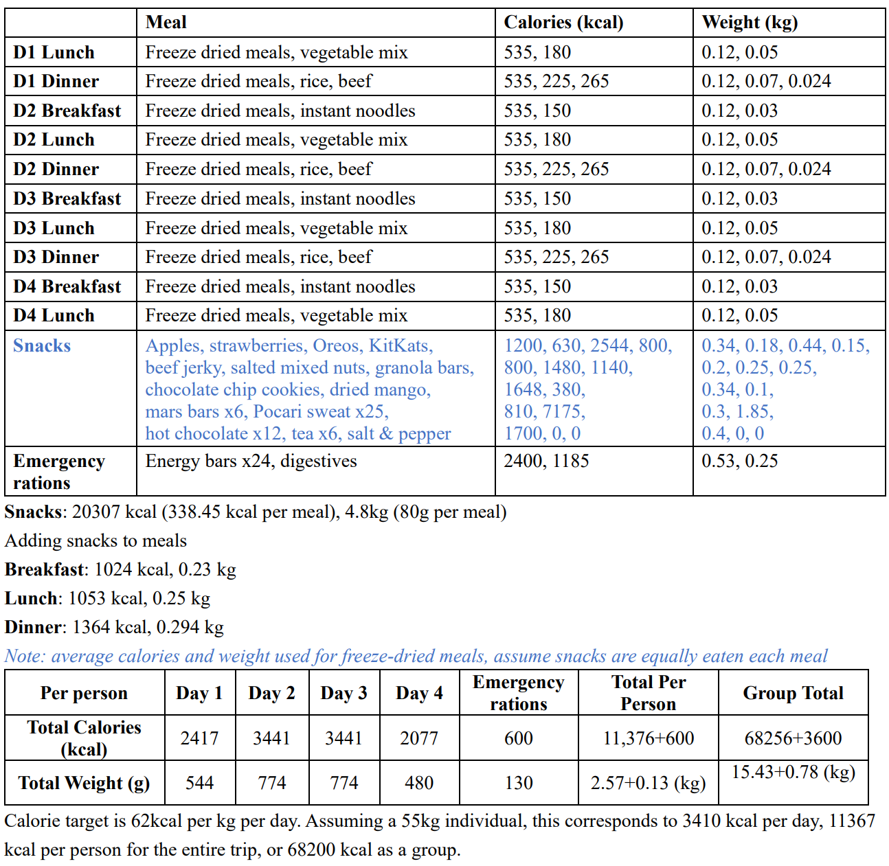
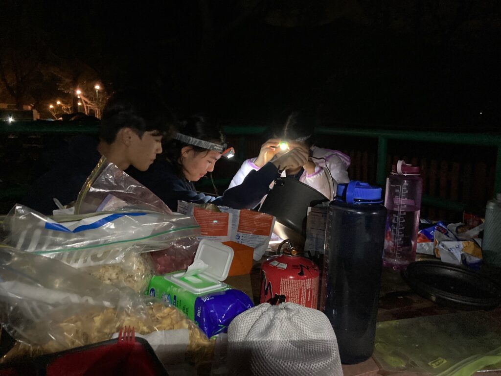
To minimize weight as much as possible, we pre-packaged all meals as freeze-dried options. In addition to the main meals, we packed snacks and emergency rations. Targeting 62 kcal per kg per day, and assuming six hikers weighing 55 kg each, our total food weight was 16 kg. Along with other equipment, including tents and cooking sets, our starting weight ranged between 14-17 kg.
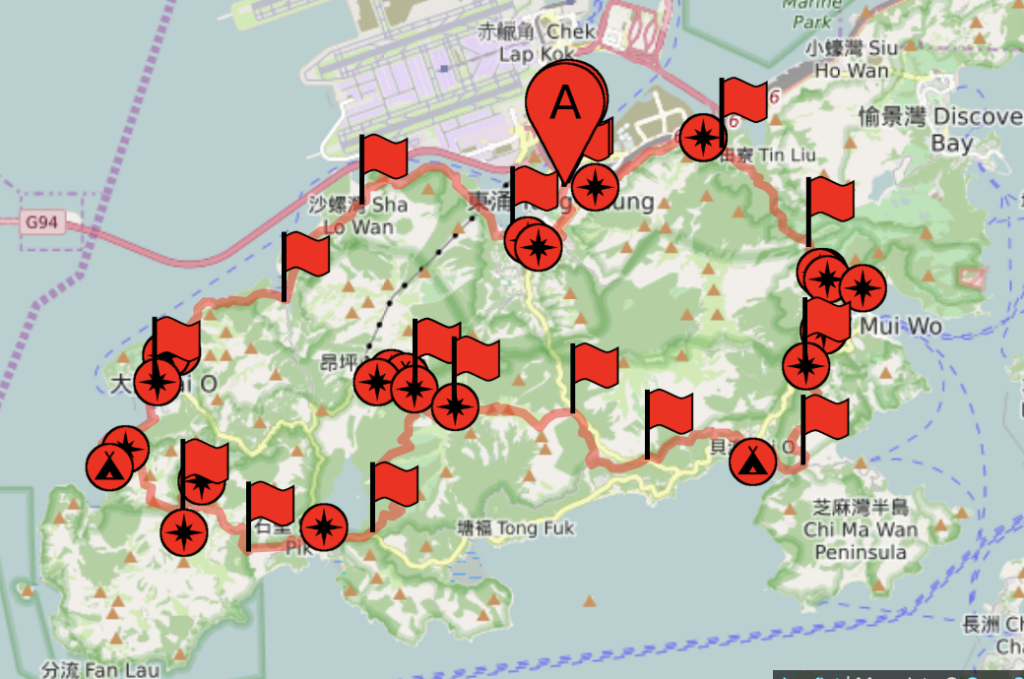
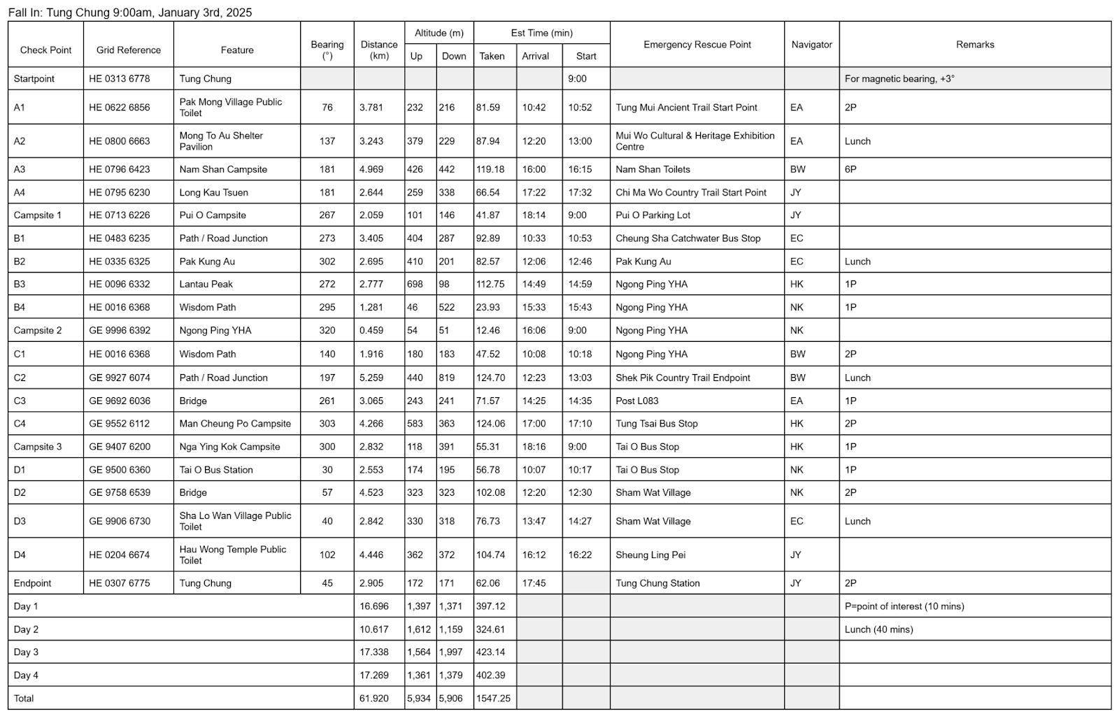
SP → A2 Tung Chung to Pak Mong Village Public Toilet
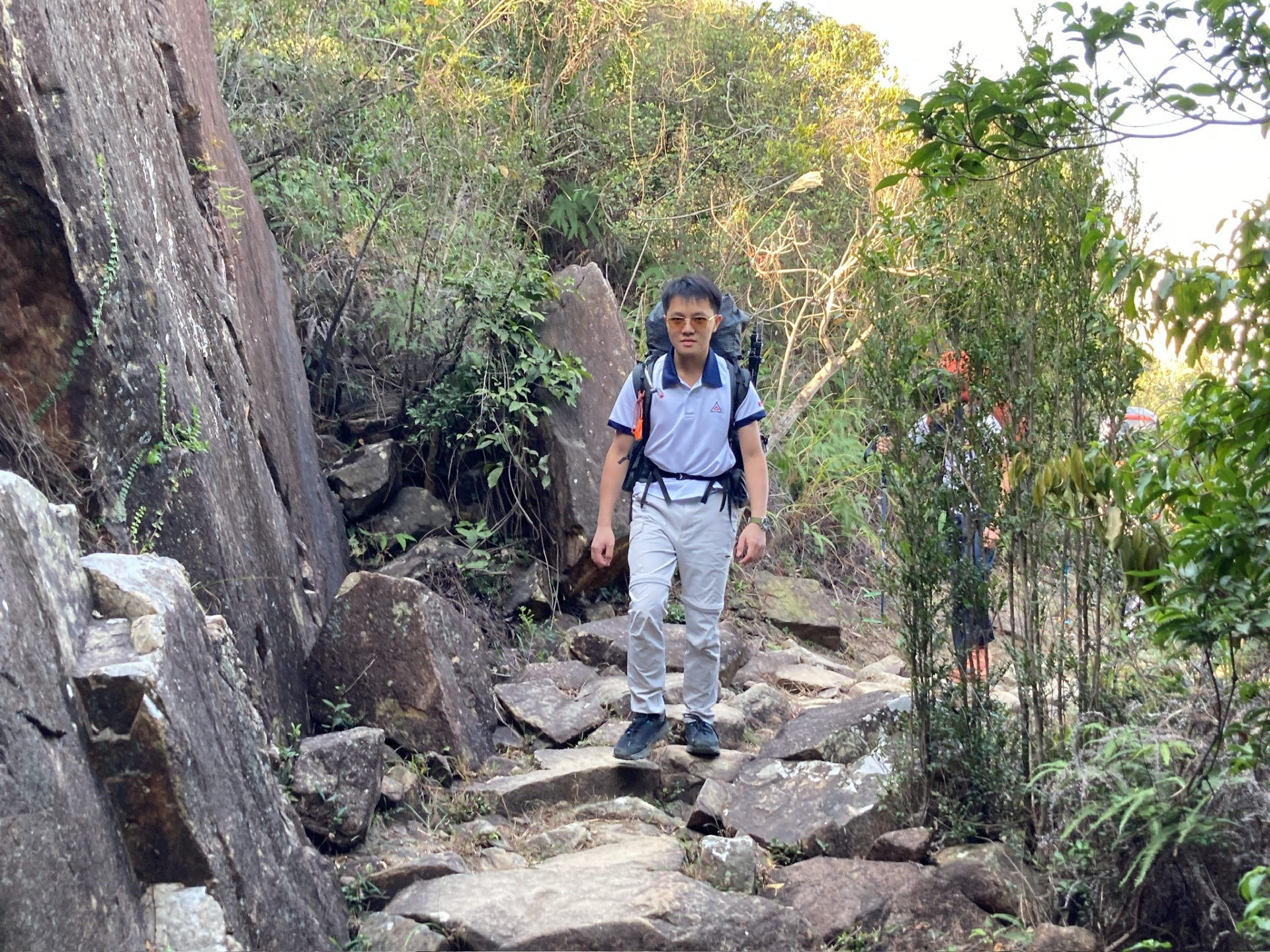
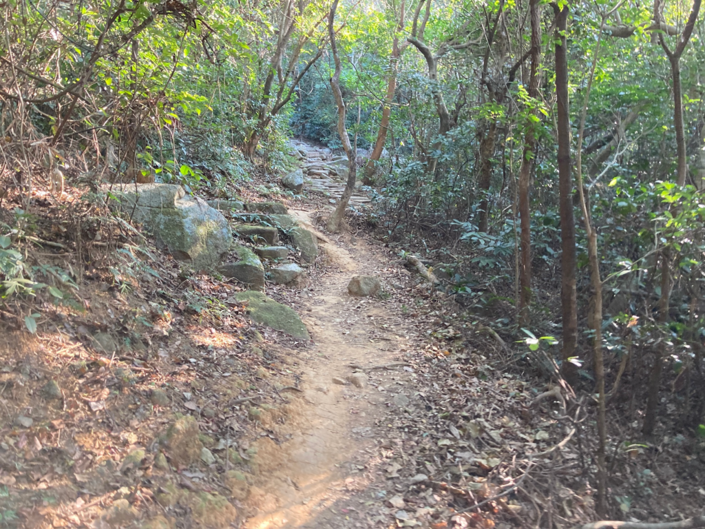
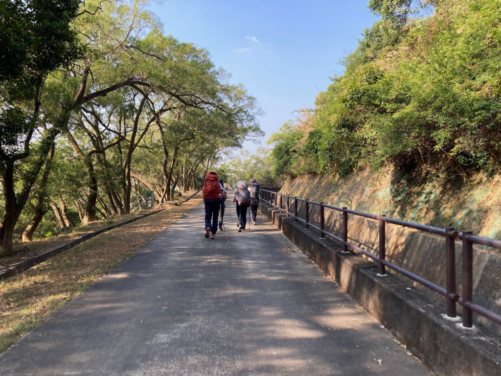
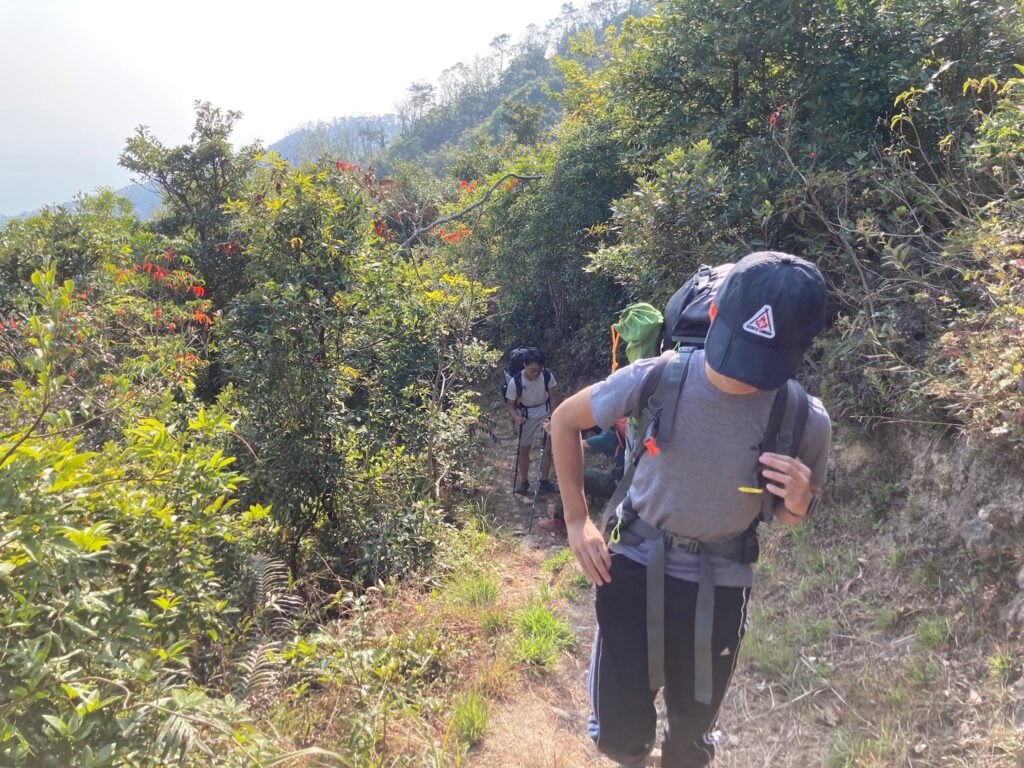
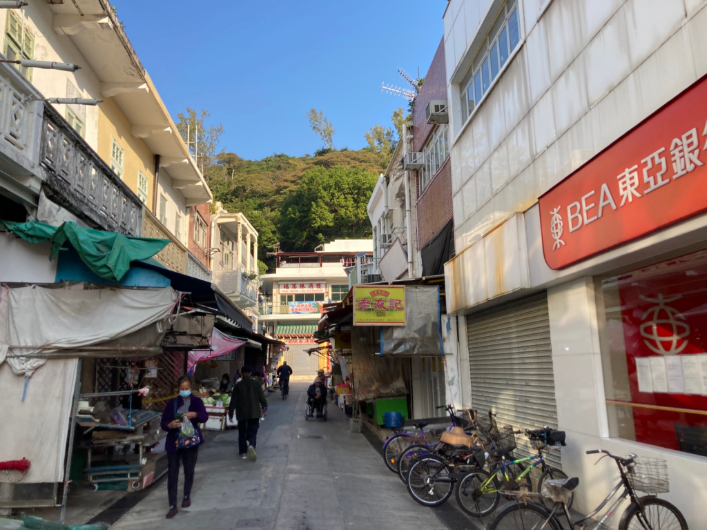
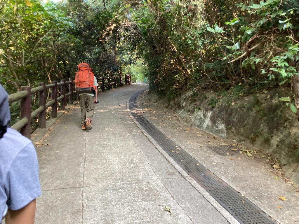
The first leg of our hike was from Tung Chung to Pak Mong Village. This section began in the city but quickly transitioned into the countryside. The path was well-maintained and easy to hike, offering beautiful views of the harbor and ocean. Once we entered Pak Mong Village, the trail to the next checkpoint, Mong To Au Shelter Pavilion, was predominantly paved.
During this first part of the hike, hikers should be cautious of traffic in Tung Chung, as there are sections where the path runs along the road. It’s advisable to stay on the sidewalk to avoid interfering with vehicles. The trail to Mong To Au included steep slopes, so hikers should pace themselves to avoid exertion.
Along the way, we passed several graveyards adjacent to the pavement. While most were set back from the path, it’s important to respect the deceased and refrain from disturbing their resting places. Hikers should stick to the trail to prevent creating new paths, as preserving the natural environment is crucial for leaving no trace.
Tung Mui Ancient Trail
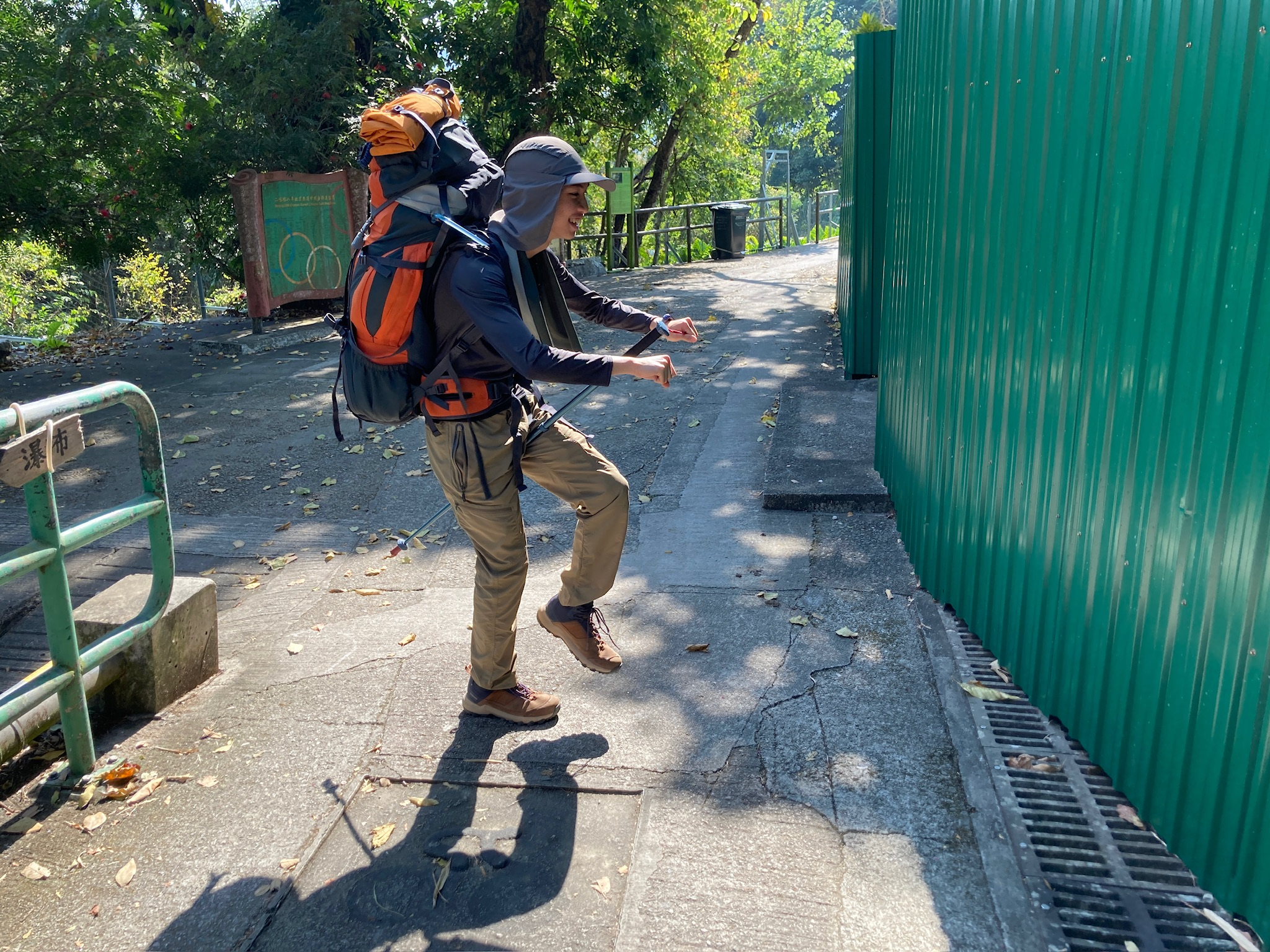
The Tung Mui Ancient Trail is a mountain path used by villagers from Pak Mong, Tung Chung, and other nearby villages to travel to Mui Wo for various business and trade purposes. It is also part of the Islands Natural Heritage Trail, specifically the Mui Wo Section. This trail begins in Tung Chung and follows the edge of Lantau Island to Pak Mong Village, then cuts into the heart of the island until it reaches Mui Wo. A section of the trail has been designated as the HK Olympic Trail, running from Pak Mong to Pak Ngan Heung. Along the way, hikers can see Silvermine Cave, Silvermine Waterfall, and Silvermine Beach.
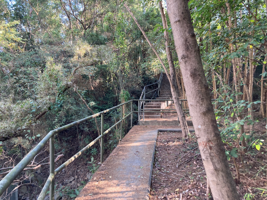
Unlike most government-maintained trails, this one is less visible and less well-kept. At the trailhead, there was a small map indicating the general direction, but we quickly became lost due to numerous intersections. The only available signage consisted of small text with arrows, written in black ink on poles, presumably by a friendly hiker. This signage was difficult to spot, and we spent considerable time searching for directions. While part of the trail was paved, the surface was uneven, and the railings were rusted.
To improve the trail’s visibility, the government should clearly mark the starting point and provide directions at intersections. Additionally, separating the car road from the trail would enhance safety, as we often had to cross the road while hiking.
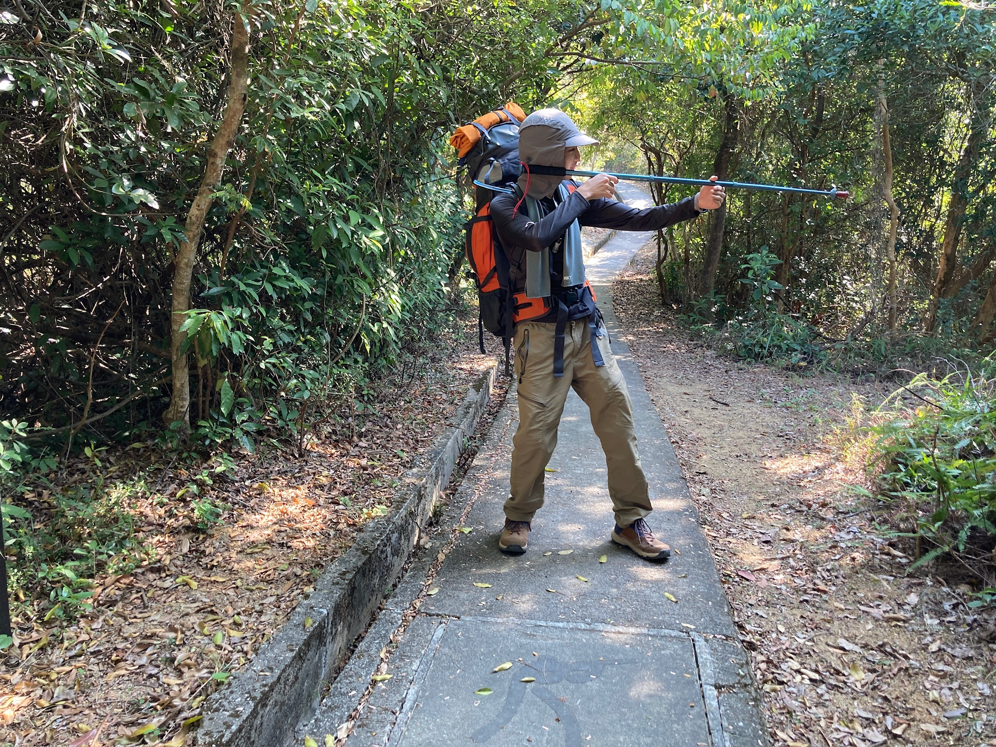
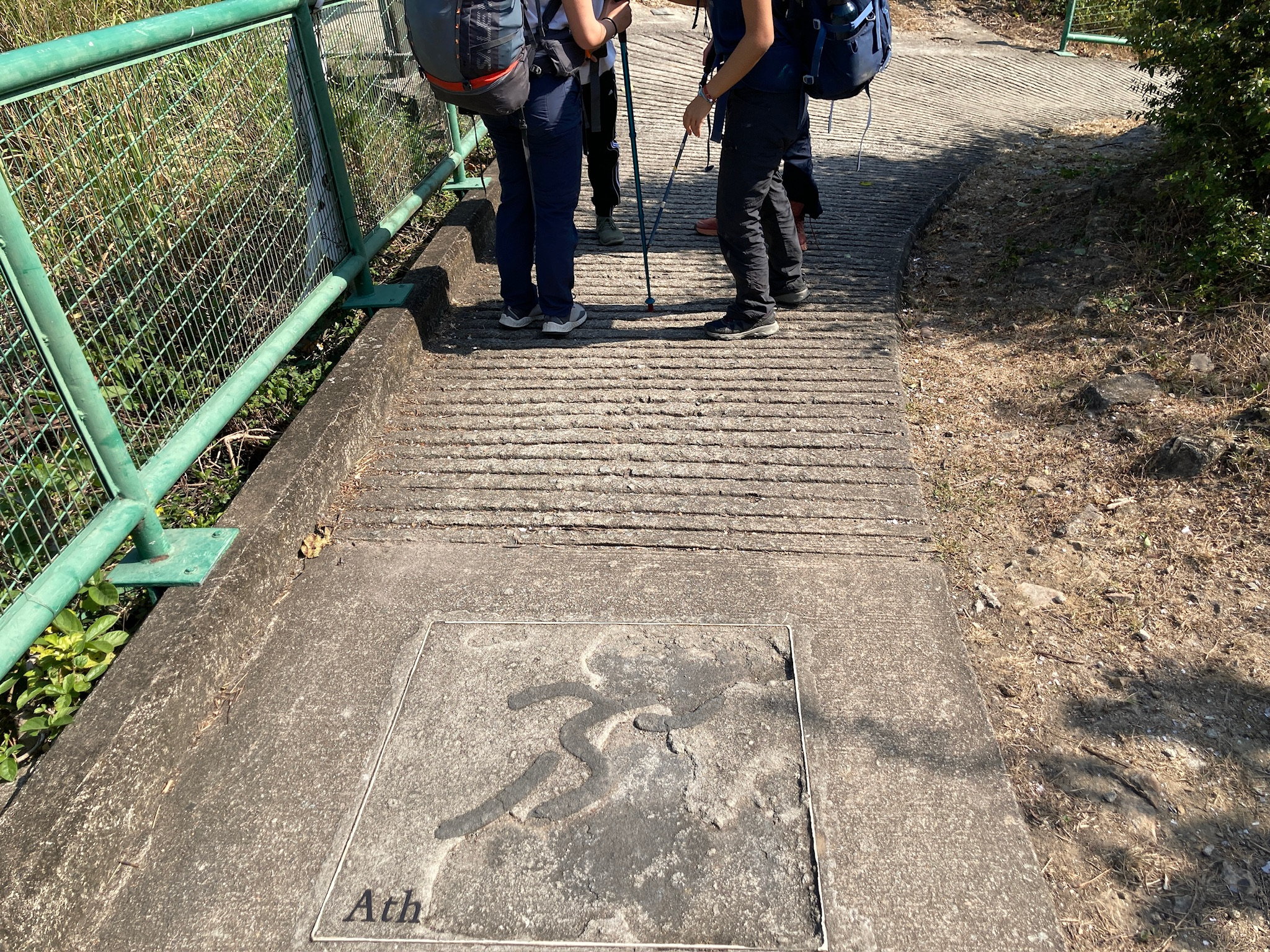
HK Olympic Trail
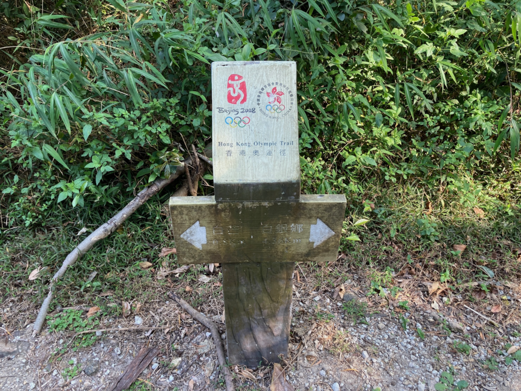
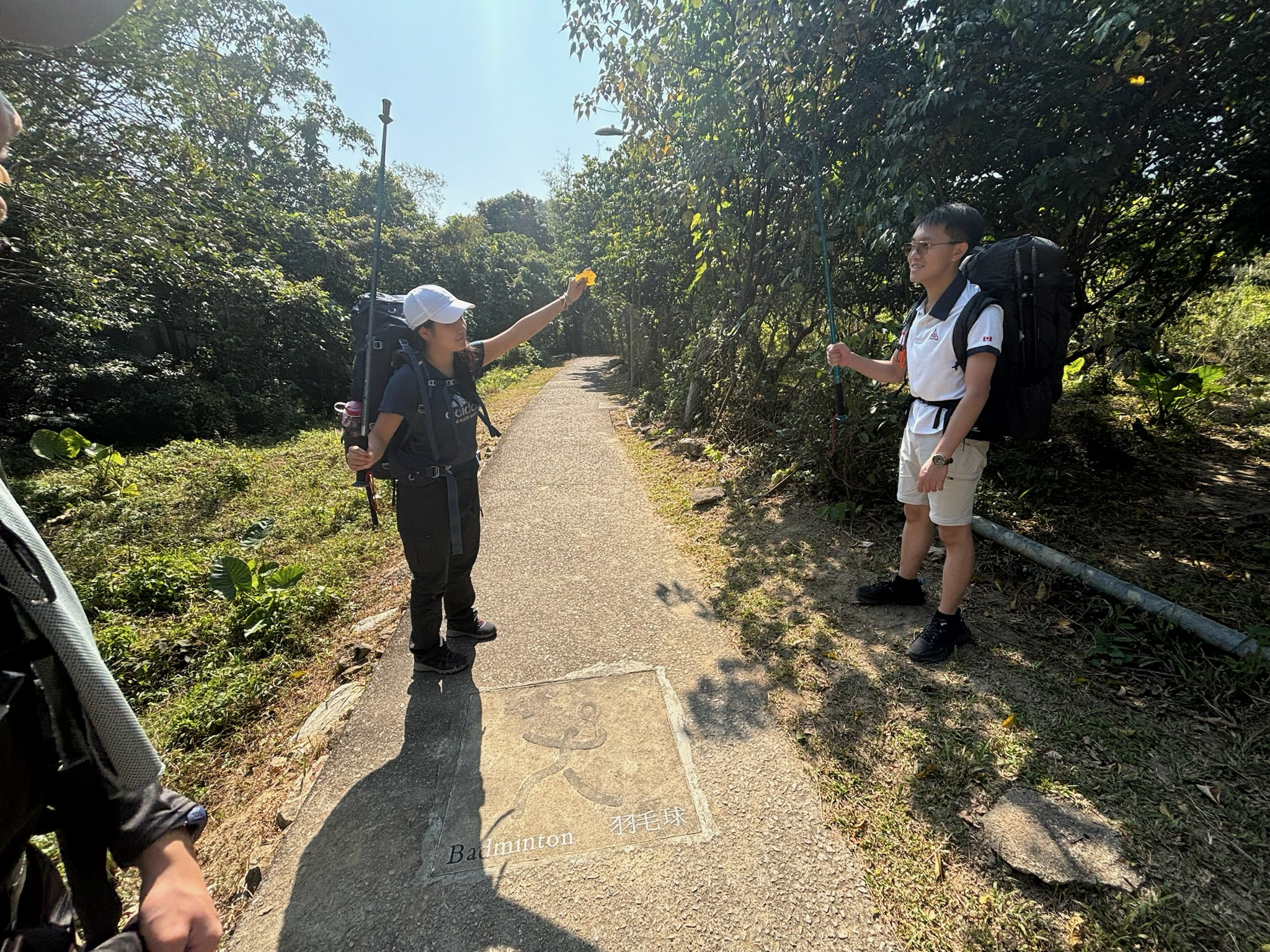
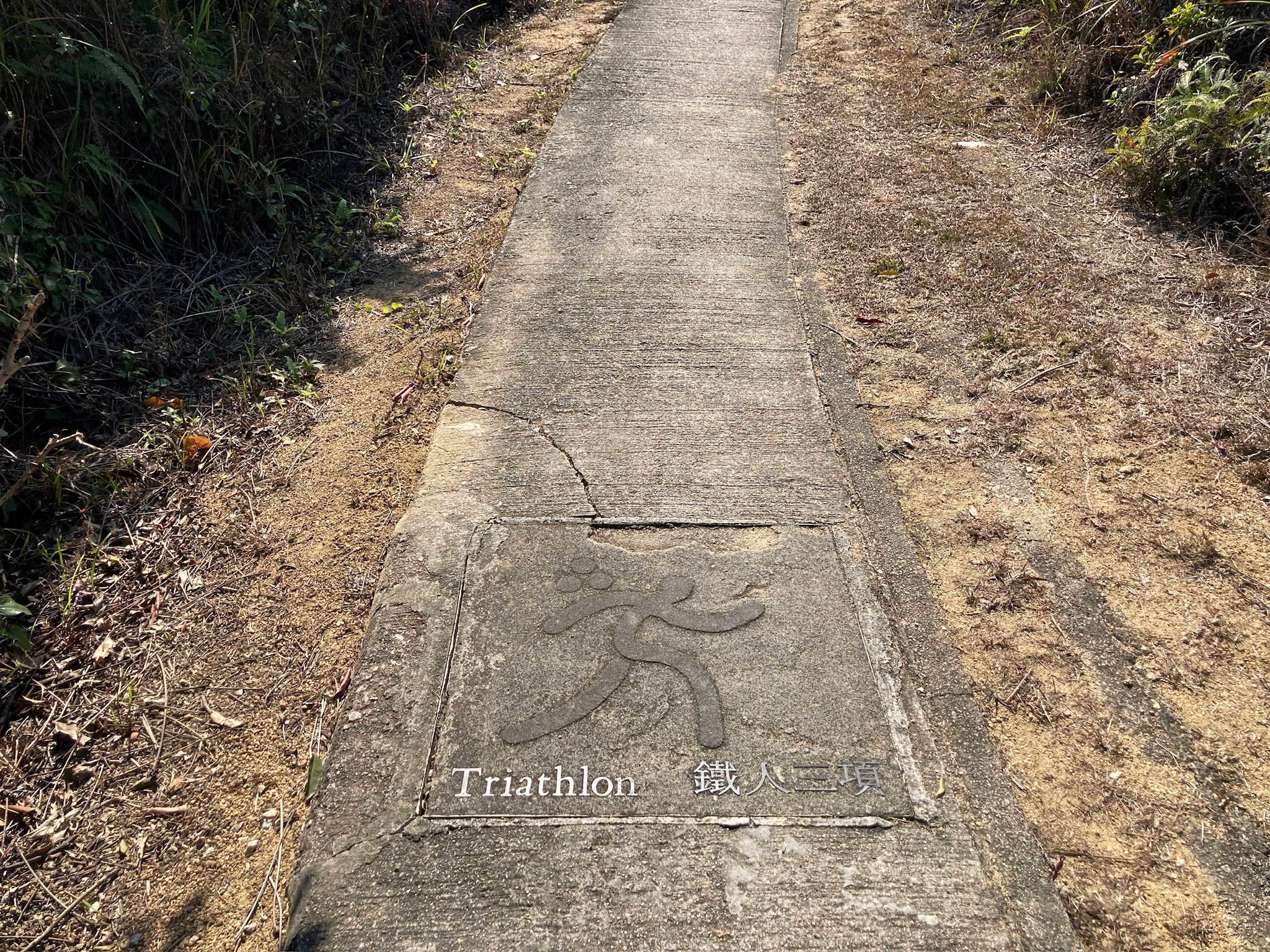
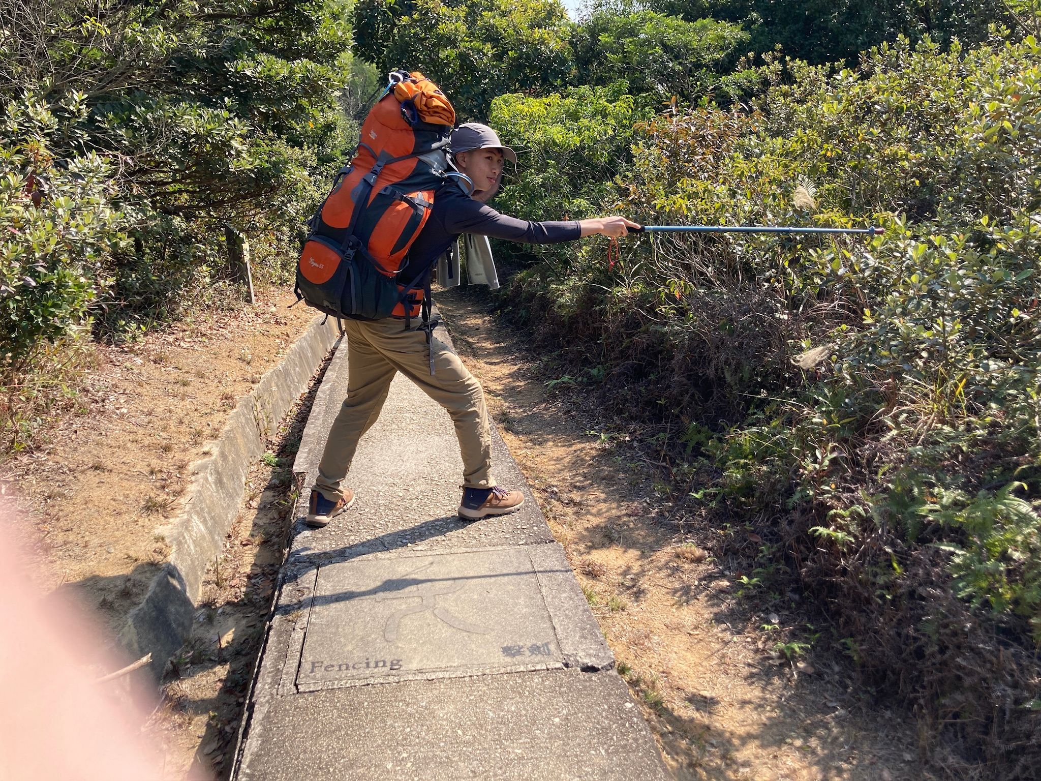
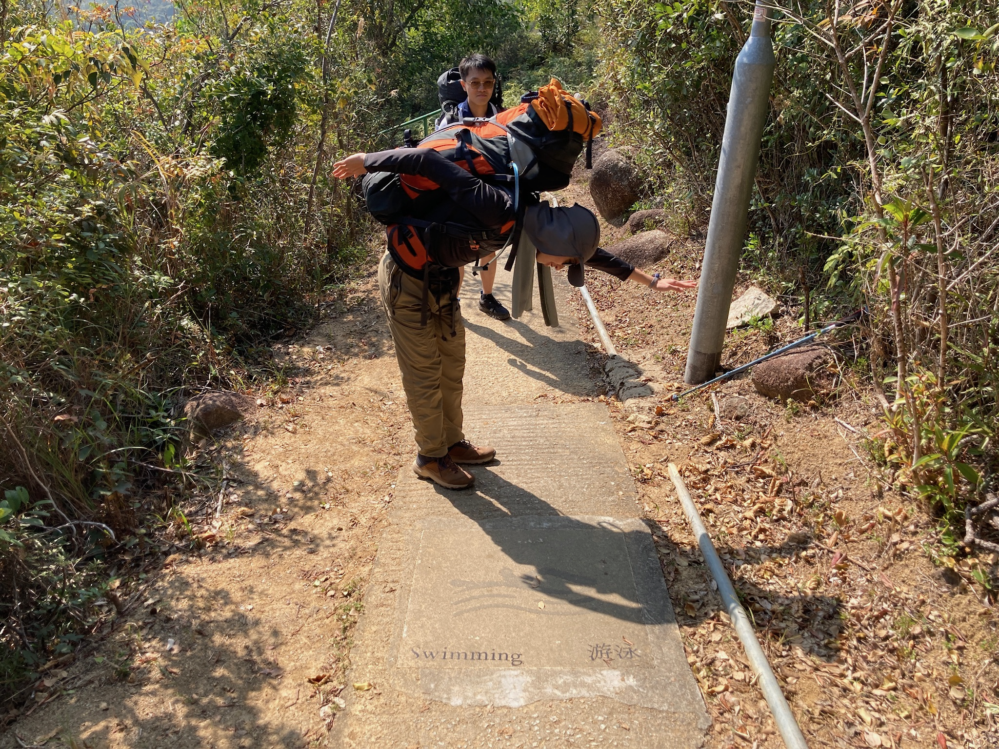
The Olympic Trail encompasses the Tung Mui Ancient Trail from Pak Mong to Pak Ngan Heung. It was named by the Hong Kong government during the 2008 Beijing Olympics to commemorate the hosting of the Equestrian Events in Hong Kong. Along the trail, visitors can find concrete pieces embedded with Olympic sports icons, including equestrianism, table tennis, rowing, shooting, triathlon, fencing, swimming, badminton, track and field, cycling, and sailing.
Despite its purpose to commemorate the 2008 Olympics, there were few features indicating its significance. Most of the concrete pieces with sports icons were faded or cracked, making it difficult to identify the sports. Although there was clear signage indicating the start and end points, we encountered a lack of signposts along the path, causing us to get lost several times.
Silvermine Cave
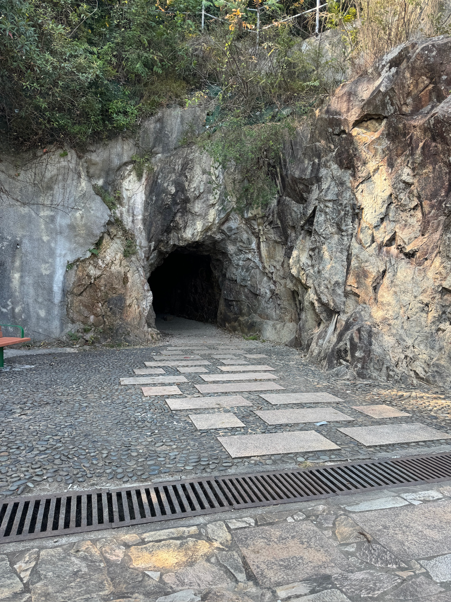
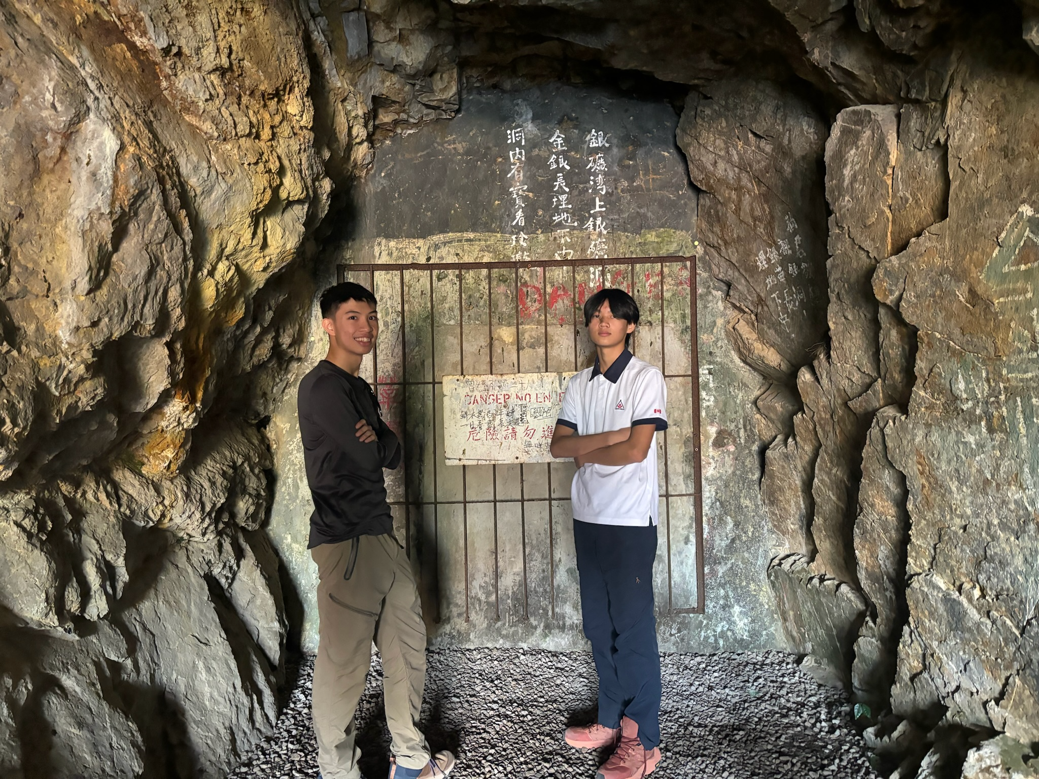
Silvermine Cave, located in Silvermine Bay in Mui Wo, was once a silver mining site that ceased operations in the mid to late 19th century due to poor silver content. The cave lies beneath the higher and lower Silvermine Waterfalls. Visitors can enjoy the stunning views from the pavilion in Silvermine Waterfall Park.
The path to the cave is nicely paved, making it a unique location in Hong Kong. However, the cave’s interior is marred by graffiti, reflecting a lack of maintenance. Additionally, there was minimal signage directing visitors, with only one visible sign mentioning the cave. To enhance the visitor experience, efforts should be made to raise awareness of the cave’s historical significance, clean up the graffiti, and improve signage so future visitors can fully appreciate this remarkable natural landmark.
Silvermine Waterfall
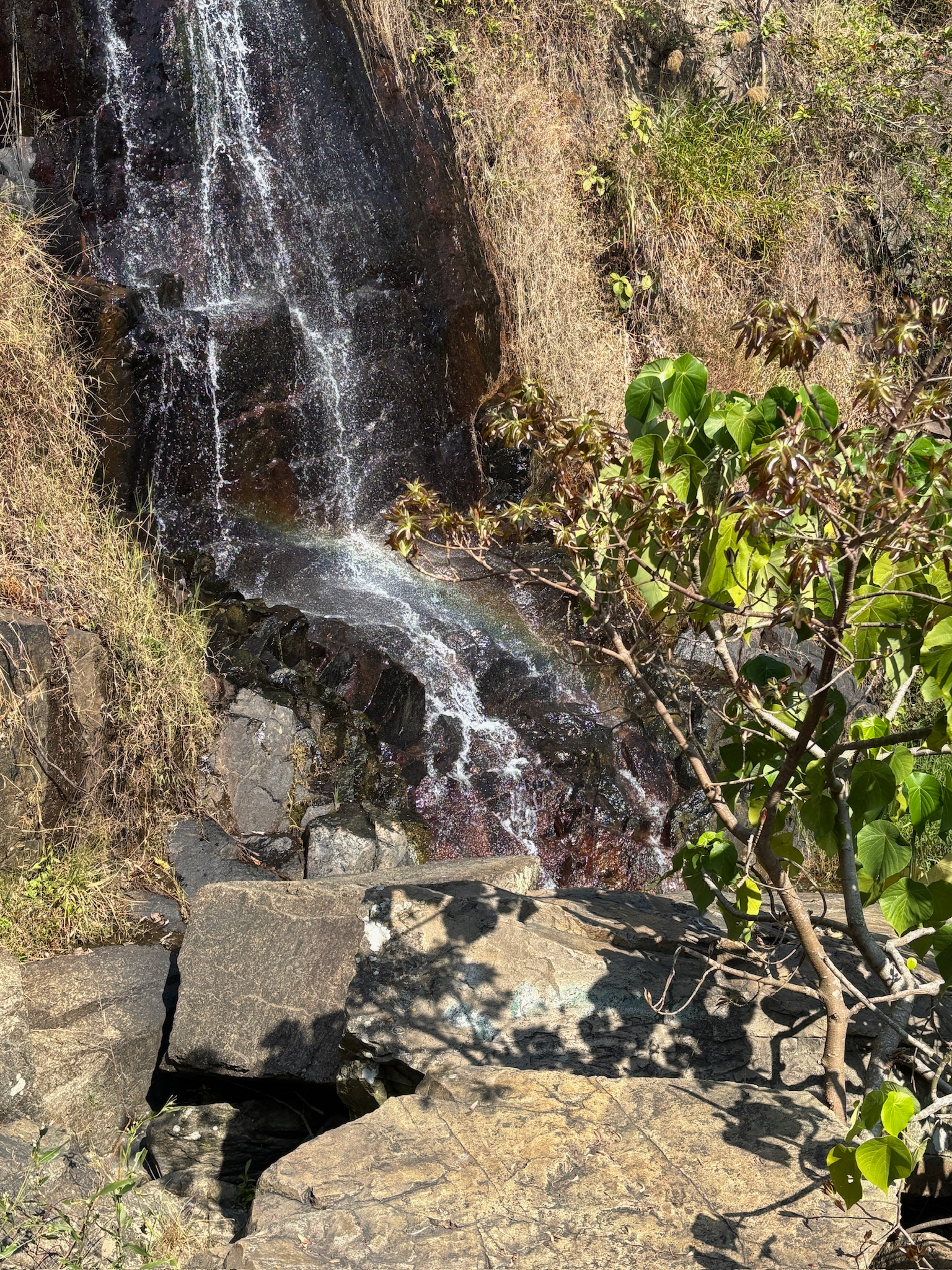
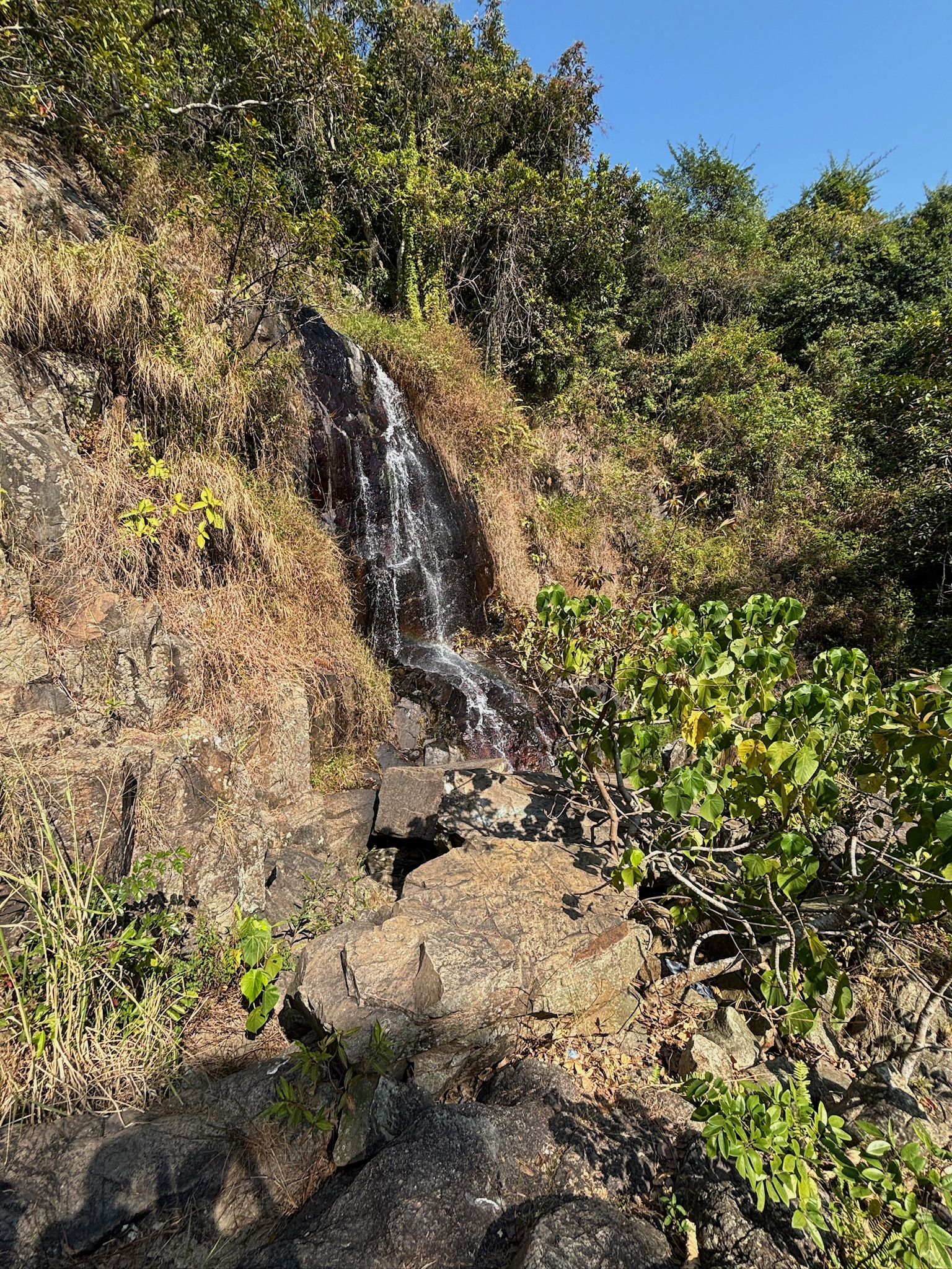
Silvermine Waterfall, located in Mui Wo on Lantau Island, is a natural attraction known for its scenic beauty and accessibility. The waterfall features a series of cascades that flow over rocky faces into pools below, making it a popular spot for hikers and nature enthusiasts. It is easily reachable with a short 20 to 30-minute walk from the Mui Wo ferry terminal. The waterfall’s appearance varies significantly with the seasons; during the rainy season, it is most impressive with robust water flow, while in drier months, it may reduce to a mere trickle.
Despite the lower water flow during our visit, the waterfall was still beautiful, and we even spotted a rainbow reflecting off the falls! A lovely Chinese-style pavilion next to the waterfall enhanced the experience. However, a broken fence, which had been covered with red tape for some time, detracted from the safety of the area. To improve the location, repairing the fence and enhancing nearby signage could encourage more visitors to explore the site.
Silvermine Beach
Silvermine Bay Beach, located on Lantau Island, is known for its accessibility and family-friendly atmosphere. Stretching approximately 800 meters, the beach features fine, slightly coarse sand and clear waters. It is well-equipped with essential facilities, including clean changing rooms, showers, toilets, and lifeguard services during the bathing season (April to October). Visitors can find several small shops offering snacks and drinks, as well as opportunities to rent kayaks for water activities.
The beach offered a beautiful view and a refreshing breeze, making the environment enjoyable. To enhance visitor experiences, regular beach clean-ups should be organized. Implementing a systematic waste management plan, including frequent trash collection and more recycling bins, could significantly reduce litter. Community clean-up events could also engage local residents and beachgoers in preserving the area.
A2 → A3 Mong To Au Shelter Pavilion to Nam Shan Campsite
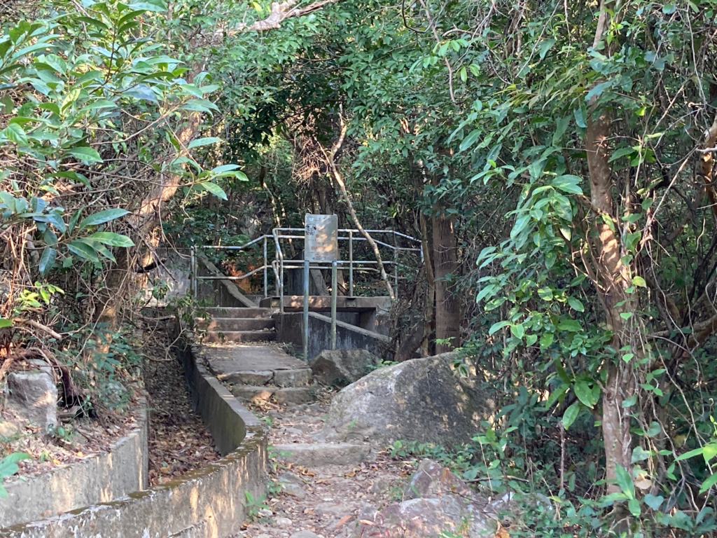
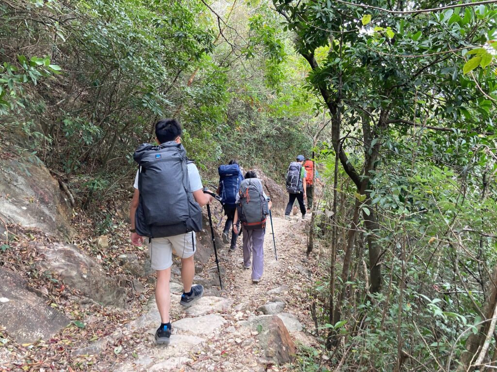
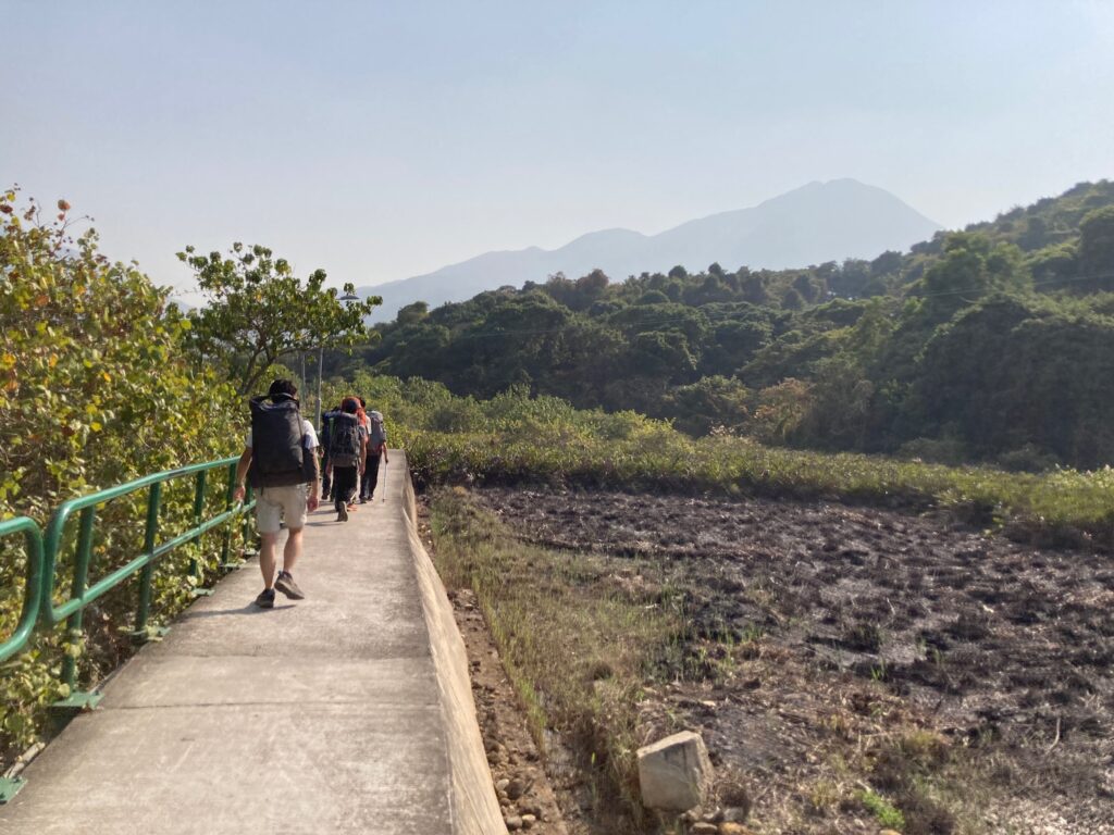
The hike from Mong To Au Shelter Pavilion to Nam Shan Campsite primarily consists of paved paths and picturesque farmland, showcasing the region’s agricultural heritage with fields of crops. There were relatively steep ascents and descents, measuring 426 m and 442 m respectively. We spotted many animals, including dogs, cats, and birds. It is essential to take precautions regarding local wildlife; hikers should avoid disturbing animals and instead observe them from a distance. Additionally, littering should be avoided, as we occasionally saw trash along the path. To contribute to the area’s conservation, hikers should carry out any trash they generate and adhere to the “leave no trace” principle.
Old Nam Shan Path
Old Nam Shan Path is a short trail connecting Mui Wo and Nam Shan. It is relatively easy, with few features along the way aside from the peak at Nam Shan. This old village path was used before the creation of Lantau South Road, allowing villagers to visit their ancestors.
The trail is easy to hike, resembling the country trails currently promoted by the government. It takes around an hour to complete, making it perfect for occasional hikers. While there was ample signage along the way, many signs were either too high, too low, or too small to notice. The trail itself was surprisingly clean, although some erosion of the rocks was evident.
To improve the trail, the government should make the signage more visible by placing it at eye level and increasing the text size. Providing background information or history about the path would also enhance the hiking experience.
A3 → CP1 Nam Shan Campsite to Pui O Campsite
The path to Shap Long Kau Tsuen was relatively well-maintained, primarily consisting of uphill and downhill stairs made from nearby rocks, with some unpaved trails. We passed a wooden shelter and a helicopter pad. Due to our timetable, we were fortunate to witness a beautiful sunset over Pui O Beach.
As we walked from Shap Long Kau Tsuen to Pui O, the sun was setting quickly, so we may have missed some features. The path was mostly a car road, except for the section passing through Ham Tin Village. On the initial downhill stretch, we saw water buffaloes near the edge of the road. We followed the river along Chi Ma Wan Road to reach the entrance of Pui O Campsite.
Hikers should be cautious of loose rocks on the uphill and downhill stairs and watch for traffic as they approach the end of the trail. Additionally, hikers should respect wildlife, such as water buffaloes and wild boars, and avoid making loud noises in the village, where many houses have open doors and windows.
Pui O Beach
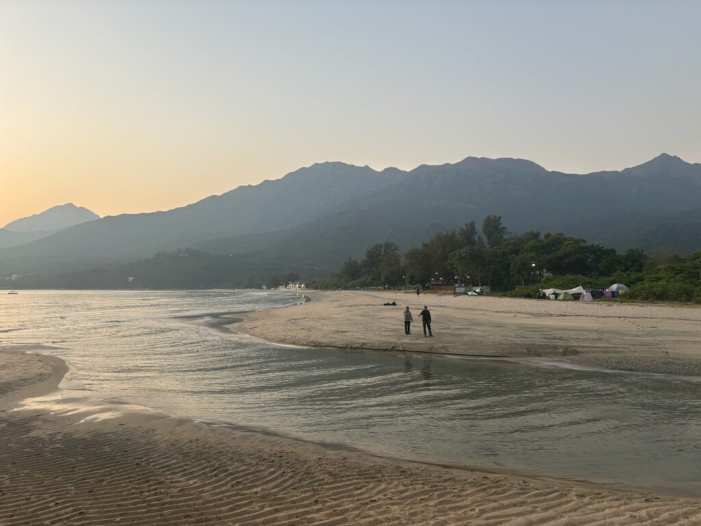
Pui O Beach is a beautiful and remote location, featuring a long stretch of soft golden sand bordered by tree-covered rolling hills, making it less known than some beaches on Hong Kong Island. Nonetheless, it attracts many visitors, including day-tripper swimmers, novice surfers, and families with young children. You are likely to spot some of the area’s famous residents: water buffaloes. On the beachfront, you’ll find a restaurant and bar, as well as a fast-food kiosk. Several local shops offer refreshments and beach equipment, and visitors can rent kayaks for water activities.
Overall, Pui O Beach was in excellent condition. The beach boasted a stunning view, fine sand, and well-maintained facilities. There was also clear signage leading to the beach. While some litter was present, the beach was significantly cleaner than many others in Hong Kong. Campers should ensure they clean up all trash before leaving to keep the beach pristine.
Pui O Campsite
Located on Pui O Beach on Lantau Island, this campsite features a picturesque camp bay and a variety of facilities, including barbecue pits, pavilions, and public toilets with changing rooms. There are 54 camp bays and an office available for any concerns.
The Pui O Campsite is popular and well-maintained, with a good condition overall. Although it attracts many campers, it remains in good shape thanks to the efforts of both campers and staff. A large sign indicates the area, and there is little to no environmental damage within the campsite. However, a long distance from the bathrooms can be inconvenient for those in the larger bays. To improve the campsite, adding a bathroom closer to the far bays would be beneficial.
CP1 → B2 Pui O Campsite to Pak Kung Au
CP1 to B1 started off as a walk on the road from the campsite, in which we then had to find a trail on the side of the road that went upwards until we reached a catchwater. The trail before reaching the catchwater is decently steep, which may be something to watch out for. Upon arriving at the catchwater, there are many bikers and other people who may be doing exercise in this area, so be careful not to disturb these people. B1 was in an area in which the catchwater intersected with the main road.
B1 to B2 continued along the catchwater, until finding an intersection into an extremely steep road, which needed to be scaled to arrive at Pak Kung Au, the base of where we began our hike into Lantau Peak. This area is extremely steep, and was one of the physically hardest parts of our walk due to the lack of shade from the extreme heat, combined with the aforementioned steepness. Once arriving at Pak Kung Au, or our checkpoint 3, there are a few break areas to rest until proceeding up Lantau Peak.
B2 → B3 Pak Kung Au to Lantau Peak
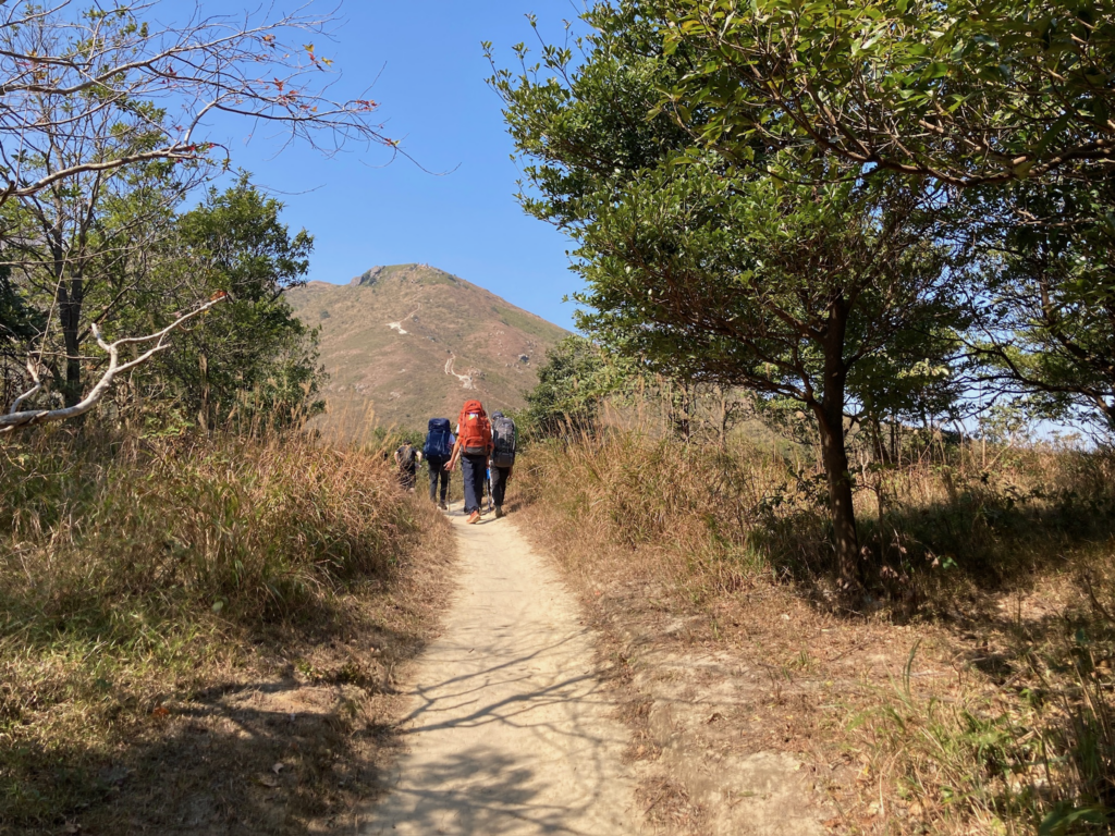

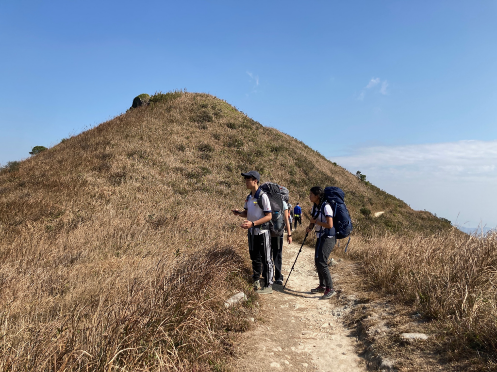
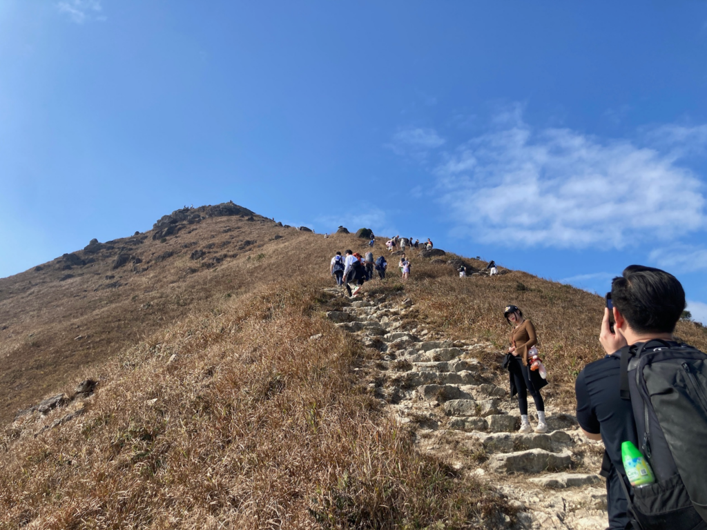
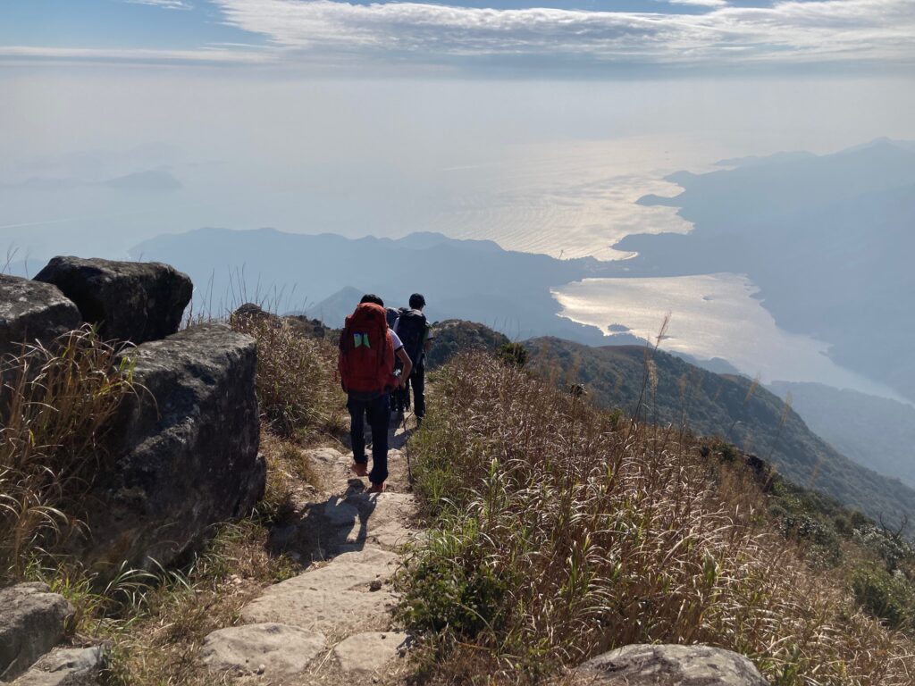
The path from Pak Kung Au to Lantau Peak, which is Section 3 of the Lantau Trail, presented the toughest challenge of our journey. We had to ascend a rocky path with high steps, climbing from approximately 320 m to 934 m, gaining 614 m in elevation. There were no trees along the route, leaving us exposed to the sun while hiking and resting. Additionally, since the Pak Kung Au BBQ site was closed, we had no lunch before the ascent and relied on small snacks.
When attempting this section, it’s crucial to take plenty of breaks. The relentless sun can lead to heat exhaustion, so protecting yourself with sunscreen and a hat is essential. Be cautious of your footing, as the steps can be quite high.
A tip for this stage is to avoid creating your own path. Although there are no trees, grass still grows along the trail, and signs of trampling were evident, which damages the environment and exposes it to sunlight, making future hikes more difficult. Letting others pass when necessary is also respectful, as this popular trail accommodates hikers at various paces.
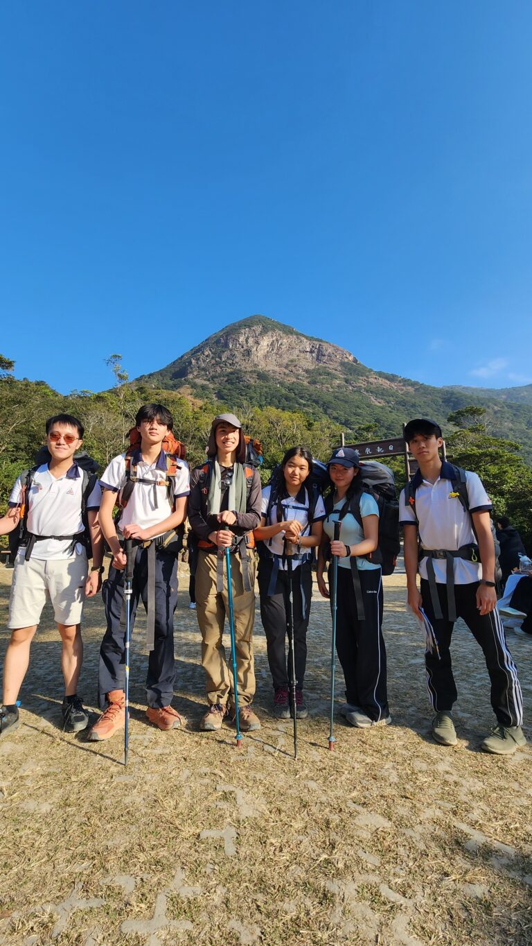
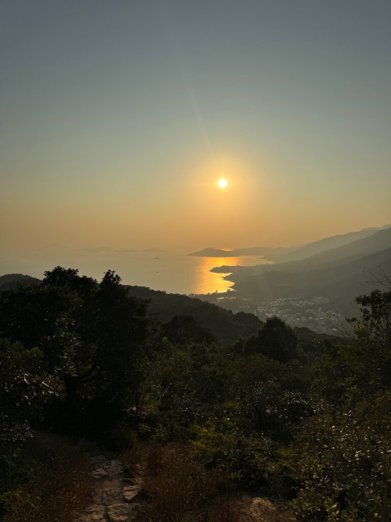
Lantau Peak
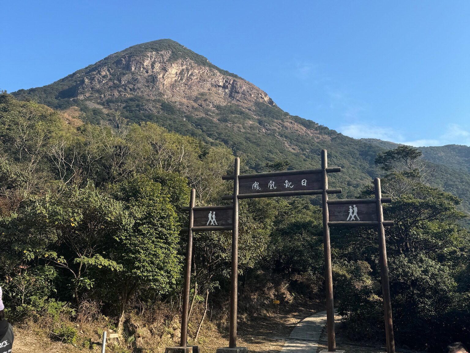
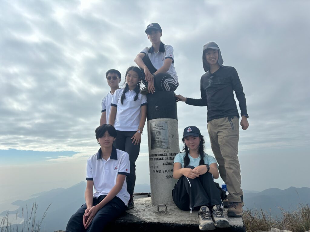
Lantau Peak, also known as Fung Wong Shan, is the second-highest peak in Hong Kong and the tallest point on Lantau Island, rising to 934 meters above sea level. The peak is composed of volcanic rocks, including porphyritic rhyolites, similar to many of Hong Kong’s tallest mountains. It is also the source of water for the Tung Chung River, a major river on Lantau Island.
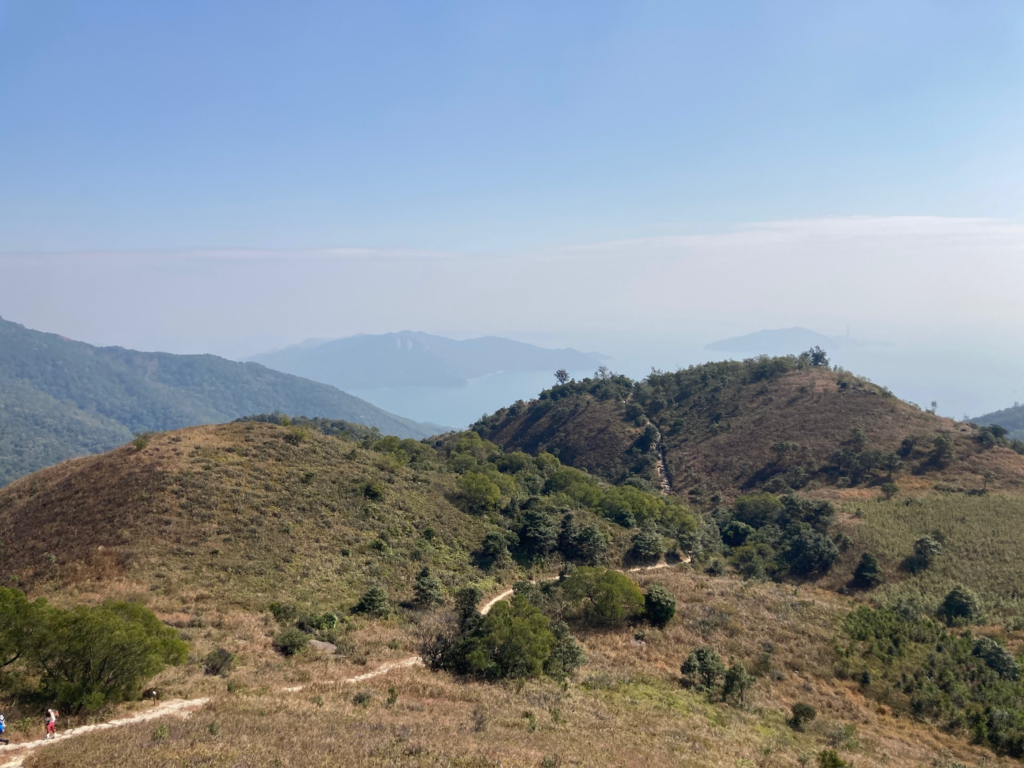
The hike to Lantau Peak was challenging, but reaching the summit was rewarding. The panoramic view from the top was breathtaking, allowing us to see for miles in every direction. However, the staircase to the peak was quite difficult, as the large steps required significant effort to climb. To improve the path, adding more, smaller steps would make the ascent easier. Although there were few signs along the way, the trail was clear. An additional improvement would be signage encouraging hikers not to trample off-trail areas, as many spots were damaged by hikers creating new paths.
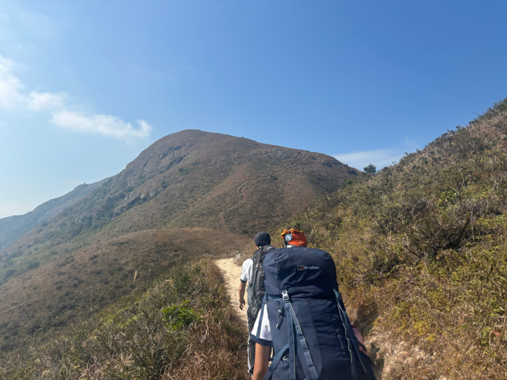
B3 → CP2 Lantau Peak to Ngong Ping YHA
The path from Lantau Peak to Ngong Ping YHA features a significant decline in elevation. It is steep, with large steps, and the road curves down the mountain, offering beautiful views. While the path is narrow, it is well maintained, with some steps reinforced with wood to prevent crumbling. The trail is easy to navigate as it opens up to Wisdom Path. However, due to the large steps, it is advisable to walk sideways and avoid rushing down the mountain. The path is not fully paved, but the rocks that make up the stairs are relatively flat. Be mindful of low signage along this route, as it can be easy to miss.
This path can become congested, as many tourists use it. It is important to keep trash with you to preserve the trail. Also, avoid using trees for support, as they are thin and may break.
Wisdom Path
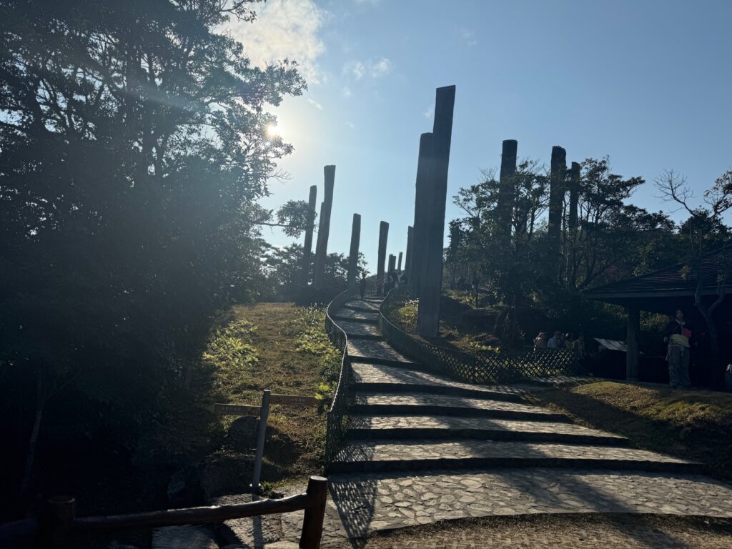
During a visit to China in 1980, Professor Jao Tsung-I was inspired by the Buddhist stone carvings of the Vajracchedika Prajnaparamita Sutra on Mount Taishan in Shandong. This led him to create a monumental calligraphic work of the Heart Sutra, a revered text for Confucians, Buddhists, and Taoists. Although simple and concise, its message is profound.
In June 2002, the Hong Kong Special Administrative Region received Professor Jao’s calligraphy of the Heart Sutra as a donation. This masterpiece is displayed as a large-scale outdoor wood inscription on a natural slope at the foot of Lantau Peak near Ngong Ping. The calligraphy is carved into wooden columns reminiscent of ancient bamboo tiles used for writing. The tranquil environment allows visitors to appreciate this blend of art and philosophy. The project was completed in May 2005.
To reflect the profound wisdom of the Heart Sutra and integrate the two-dimensional calligraphy into a three-dimensional architecture, the thirty-eight timber columns inscribed with the Heart Sutra were arranged to correspond to the landscape’s topography, forming a figure-eight configuration symbolizing infinity. The highest column is left blank to suggest the concept of “emptiness,” a key theme in the Heart Sutra.
Overall, Wisdom Path is well maintained. The columns and surrounding staircase are in good condition, with minimal damage to the path. There is clear signage leading to the trail. One suggestion for improvement would be to add more fences. Although most staircases are lined with fences to prevent hikers from leaving the path, a small section currently lacks them. Adding fences in this area would enhance the safety of Wisdom Path.
Ngong Ping YHA
Ngong Ping YHA is located in the center-right of Ngong Ping and serves as a Youth Hostel Camp with numerous accommodations and facilities. Its offerings include twin rooms, double rooms, triple rooms with trundle beds, 4-person private dormitories, 6-person private dormitories, multi-person dormitory beds, bell tents, regular tents, and camping grounds. Facilities include Wi-Fi, a shared barbecue site, a self-catered kitchen and canteen, shared bathrooms, outdoor spaces, and lockers.
Ngong Ping YHA is a well-maintained campsite and youth hostel, offering high-quality facilities, making it one of the best options in Hong Kong for those on the trail. However, the signage is not very prominent; the entrance is somewhat hidden and lacks clear indications aside from a small plastic sign. There is some environmental damage at the entrance due to a shortcut made by visitors, although it is not significant and does not affect the overall quality of the hostel. To enhance its visibility, larger signage should be added, and efforts should be made to repair any environmental damage around the entrance.
CP2 → C1 Ngong Ping YHA to Shek Pik Country Park
The journey from Ngong Ping YHA to Shek Pik Country Park is a scenic route that showcases the natural beauty of Lantau Island. The path is lush with greenery, and on the way, the Wisdom Path itself features a series of wooden monuments inscribed with verses from the Heart Sutra.
While the trail is generally well-maintained, hikers should take precautions due to rocky terrain, which can be uneven and challenging in certain areas. Wearing appropriate footwear is essential for safely navigating the rocky paths. To preserve the beauty of the natural environment, it is vital to follow conservation practices, particularly by ensuring that no litter is left behind. Carrying out any trash, including food wrappers and water bottles, helps maintain the pristine condition of the area for future visitors.
Po Lin Monastery
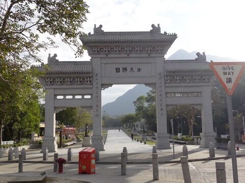
During the First Opium War, which began in 1840, many people from Mainland China, including Buddhist clergy, migrated to Hong Kong. The first settlers were pleased to find flat land in the mountains, although it was overgrown with thorn bushes and access was challenging. Over the years, the monks cultivated the land, creating a serene place for religious practice. The initial settlements consisted of small huts and meditation rooms. The largest monastery, originally named Tai Mao Pung (大茅蓬), meaning “Big Thatched Hut,” was founded in 1906 by Ven. Da Yue.
In 1924, at the request of the monks, Ven. Ji Xiu came to Hong Kong from the Jinshan Temple of Zhen Jiang and became the chief incumbent. He renamed the monastery to what it is known as today—Po Lin Monastery (寶蓮禪寺). In doing so, Ven. Ji Xiu became one of the founders and the first Abbot of Po Lin Monastery.
In March 1979, a delegation representing the Buddhist community of Hong Kong visited China at the invitation of the Buddhist Association of China. This marked a thaw in relations between the Buddhist communities in Hong Kong and China after a 30-year freeze. To commemorate the occasion, a set of Qianlong Tripitaka was presented to the Po Lin Monastery. The Qianlong Tripitaka consists of three sections: sutras (Buddha’s sayings and sermons), vinaya (rules of the monastic orders), and abhidharma (higher philosophy), totaling 7,173 volumes. Fewer than 150 copies were published between 1735 and 1738 AD during the Qing dynasty, and today, fewer than 30 copies remain globally.
The Po Lin Monastery and Tian Tan Buddha Statue are in excellent condition, with well-maintained buildings, courtyards, and gardens. Signage is clear, often accompanied by maps and descriptions of each location, which is expected for a tourist site. We were unable to enter the Buddha Statue as we arrived at 8:15 AM, which was understandable since it is unlikely that many tourists would arrive at that time.
Tian Tan Buddha Statue
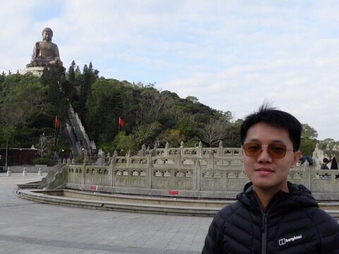
In 1973, the monks of the Po Lin Monastery were inspired to build a Buddha statue after visiting the Kamakura and Changhua Buddha statues in Japan and Taiwan. Following the opening of China in 1979, the monks had the opportunity to visit the statues of Longmen and Dunhuang, as well as Tian Tan (Altar of Heaven) in Beijing. This led to the conceptualization of the statue on a base platform, with the hope that it would serve as a source of spiritual comfort and inspire visitors to purify their minds and achieve inner peace.
The design of the statue is based on the 32 lakshanas, which are the physical characteristics of the Buddha described in the sutras. Each part of the statue symbolizes the Buddha’s virtues. The Buddha sits on a lotus that grows from mud, representing purity and the ability to save all beings from suffering, embodying compassion and impartiality. Each palm displays a Dharmachakra (wheel of law), signifying the Buddha’s eternal truth.
Constructed from a steel frame and 202 bronze castings, the statue weighs a total of 250 metric tons. The face piece alone measures 4.3 by 5.8 meters and weighs 5 metric tons. The assembly and welding were conducted outdoors, starting from the bottom and moving upwards. To preserve the bronze castings, a protective surface coating was applied to prevent fading and corrosion.
C2 → C3 Shek Pik Country Trail to Bridge
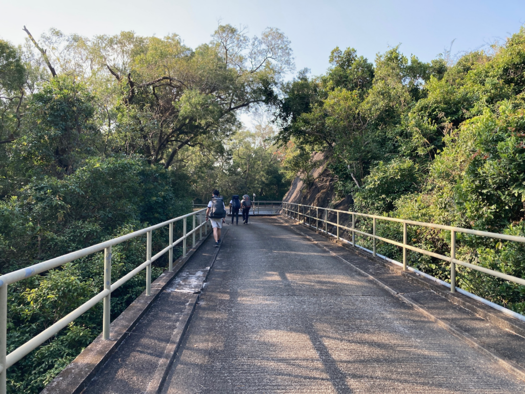
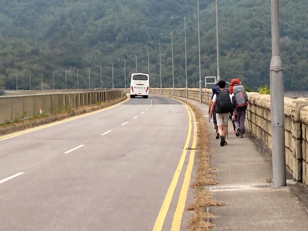
The section of the hike from Shek Pik to the bridge primarily follows the sidewalk along the road, with a notable feature being the giant dam. The dam extends for quite a distance, providing lovely views. Most of the path is paved, making it easy to walk.
When hiking along this road, it is crucial to stay on the sidewalk, especially on the dam, where vehicles tend to travel at high speeds. Adding railings between the road and the sidewalk along the dam could enhance pedestrian safety.
Shek Pik Reservoir
In the 1950s, Hong Kong experienced significant water shortages, prompting the government to construct the Shek Pik Reservoir in the Shek Pik Heung valley, using contractor Soletanche. The main water source for the reservoir is the Tung Chung River, which supplies water through a series of tunnels and underground pipes to the reservoir.
The reservoir area is well-maintained, surrounded by sturdy walls in good condition. There are signs indicating the road leading into the reservoir, and a small parking lot is available for visitors to take photos of the reservoir and the nearby Big Buddha.
To improve this site, an informational plaque detailing the history of Shek Pik could be added. Including pictures of its past and a timeline would enhance visitors’ understanding of the area’s significance.
C3 → CP3 Bridge to Man Cheung Po Campsite
The journey from Checkpoint C3 to Man Cheung Po Campsite was straightforward, with a few junctions but generally easy navigation. The path consists mainly of stairs, with limited shaded areas at higher elevations. During our break at Man Cheung Po, two teams were dispatched to Lung Tsai Ng Yuen and the Flying Dragon, both located a considerable distance from Checkpoint 4.
The final stretch involved slight uphill climbs before descending back to sea level. The unpaved uphill section required caution, while the descent was well-maintained, featuring paved roads and sturdy stairs. Although a landslide warning was posted, the affected area was short, allowing us to continue on our planned route.
Flying Dragon
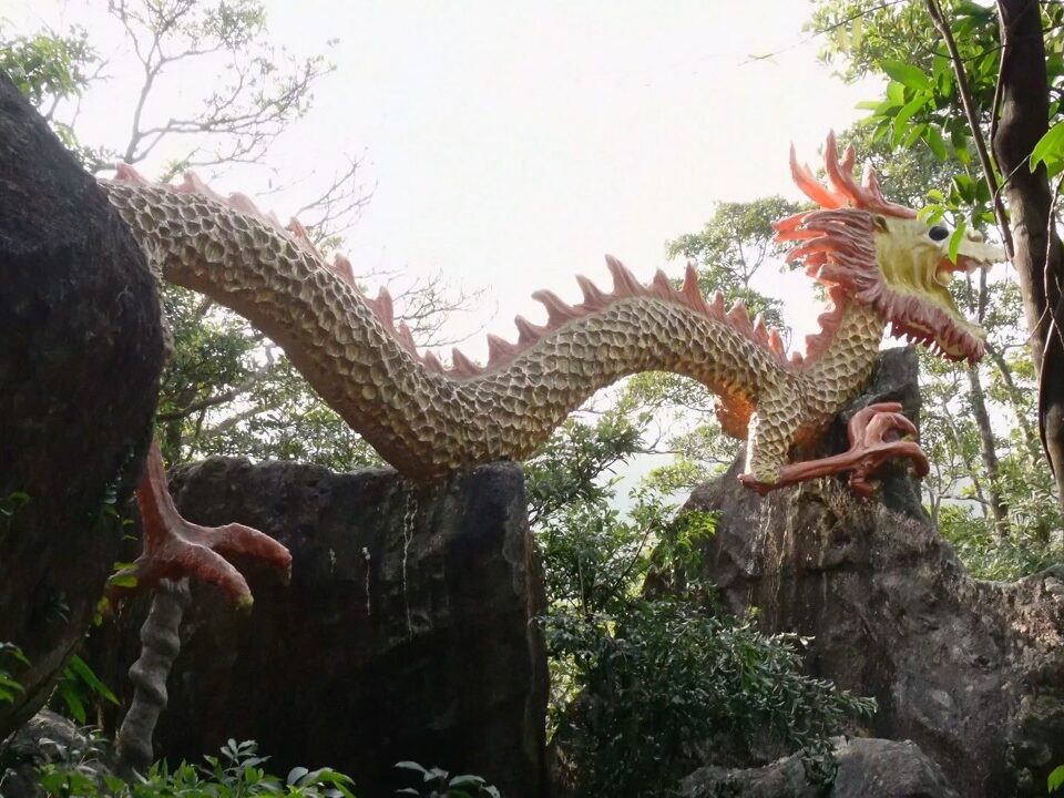
Located in the Man Cheung Po area, the Flying Dragon is a landmark where many hikers stop for photos. Man Cheung Po is nestled between Ying Long Shan and Keung Shan Au. The area features the nearby Tsz Hing Monastery and Man Cheung Po Campsite.
To see the Flying Dragon, visitors must seek permission from the monks or residents of Tsz Hing Monastery, as there are no signs directing visitors to the dragon. This lack of signage is likely intentional, as the monks prefer to keep their sanctuary private. The dragon itself is well-maintained and in good condition, despite its unconventional location. The area shows little to no environmental damage.
Lung Tsai Ng Yuen
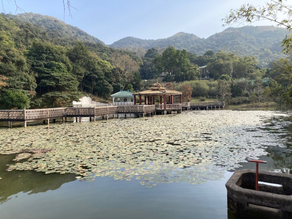
Lung Tsai Ng Yuen is a hidden garden located 2 kilometers from Tai O Village. Built by Woo Kun Sheng in the mid-1960s as a Jiangnan-style garden, it reflects his Buddhist values and appreciation for the serene environment. The garden features a lily and koi pond beneath a nine-bend bridge, along with various plant species, including bamboo and ornamental trees imported from China.
The garden’s condition is generally acceptable, with clear signs marking the area. However, some bridges show signs of wear, and missing fencing poses a safety risk. Promoting the garden to tourists and educating them about Hong Kong’s history would be beneficial. Fixing the fencing and reintroducing diverse animal species could enhance the ecosystem.
Nga Ying Kok Lookout
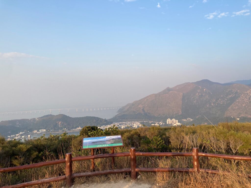
This lookout overlooks 1.3km of Yi O’s rocky beach line. From here, you can see all the way to China if you observe the small islands in the distance. Tai O is renowned as ‘Hong Kong’s Venice’, as it used to be an old fishing village that specialised in salty fish and fish paste. Tourists find that Tai O still retains its many traditions and natural ecology despite the length of time passed from its original glory. The site is surrounded by many trees and bushes, and an exposed water source can be seen running through the site. Nga Ying Kok was previously thought to be an iron ore mine, producing 3000 tons of ore a month to sell to the Japanese market. This mining operation was unsuccessful, but this site has now been converted to a campsite.
In World War 2, this area was strategically significant because it could overlook enemy movements. This observation deck was used to defend Hong Kong’s borderlines. During the colonial period, Nga Ying Kok saw significant infrastructural development in order to make this area more accessible. Trails and roads were reconstructed, and agricultural lands saw a shift into urban landscapes.
Finally, in the 20th century, with environmental movements taking center stage in the government’s focus, several programs were implemented in Lantau, and Nga Ying Kok was one of them. Guided hikes, cleanup workshops and more were started to preserve this area’s ecology and cultural significance.
The conditions are pretty well maintained, there are benches to sit on, the grass does not block the view. There is a detailed map at the lookout, with labels to the places visible from that point. It also had brief descriptions. Near the lookout, there was a small camping area and a shelter. However, mowing the grass at the viewing point would help. The grass has yellowed over time and should be regrown or removed.
Nga Ying Kok Campsite
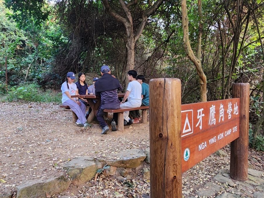
Located near Yi O Kau Tsuen and Fan Kwai Tong, Nga Ying Kok Campsite offers basic facilities, including untreated stream water, toilets, and camping areas. However, it suffers from poor maintenance, with a rat infestation in the already inadequate bathroom facilities. The beach nearby is also dirty, requiring cleanup efforts.
To improve this campsite, a better bathroom should be constructed, and measures should be taken to eliminate the rat problem. Additionally, cleaning up the beach and providing a source of clean water would greatly enhance the experience for visitors.
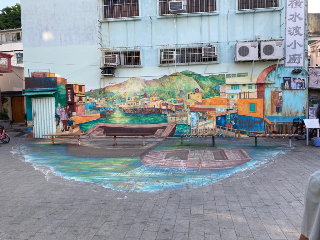
Tai O Fishing Village
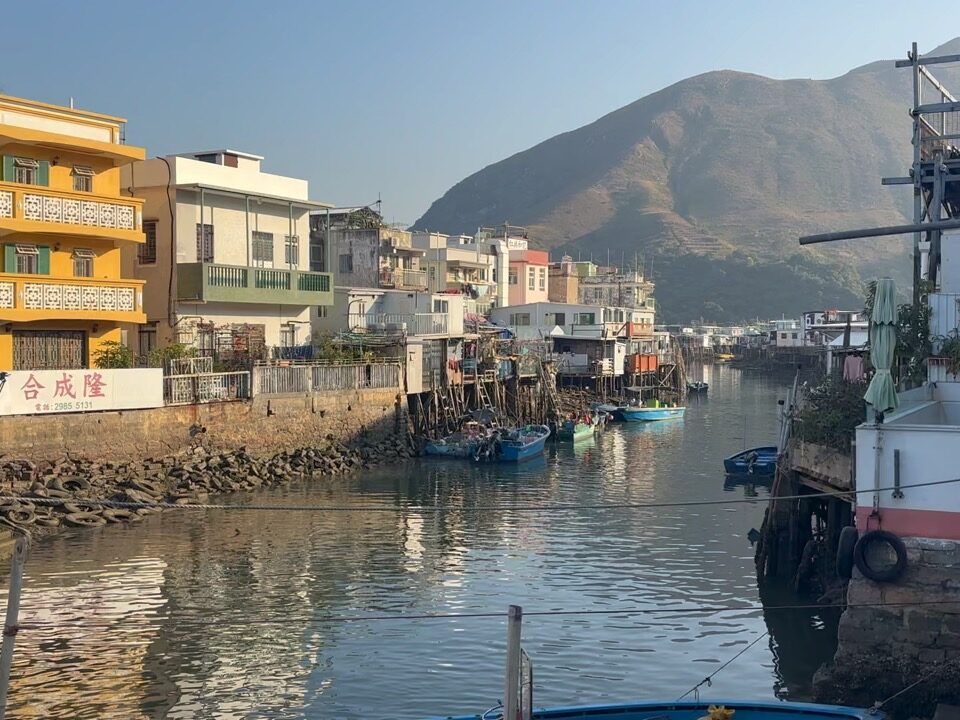
Tai O was famously named the ‘Venice of the Orient’ and grew very well known for its serene atmosphere compared to the bustling city of Hong Kong. It was founded by the nomadic Chinese Tanka tribe out of necessity during the Ming Dynasty. The village since then has prospered through making salted fish and salt, however, in recent years these have scaled back with only a few shrimp paste and salted fish industries remaining. So, the Hong Kong Tourism Board provides new, orange boats to fishermen in the area. In the past, the cable ferry was how people made their way down the Tai O River. Now, there is a bascule bridge built to make transport more efficient. Along the river channel, there are traditional stilt houses called pang uks ( 棚屋) where people still live today. This architecture gives Tai O its name, as the floating houses remind people of the city of Venice. On some occasions, Chinese white dolphins can be spotted in Tai O’s waters. But with recent environmental developments, these have become more rare. A problem this village faces is adaptation to the increase of the severity of natural disasters like typhoons. More of the younger generations have started to move inland in search for more stable housing and look for more jobs outside of the fishing industry.
The conditions were quite well maintained, as the stick houses have been afloat for many years, but in recent times, due to global warming (strong winds and rising sea levels), the fragile infrastructure on and off the land has been subject to more destruction. In some areas, the signs are missing letters and are fading, so navigation to tourists/travellers would improve if the signs were better maintained.
There is minimal trash in the water as the people of Tai O respect their area, but with the increase of trash in the ocean, there’s no doubt that trash flows from the ocean into the village. Furthermore, Tai O offers pink dolphin tours, but sightings of these have become increasingly rare, as the boats in HK’s waters often hurt or kill them. A species that is almost going extinct should not be a tourist attraction.
CP3 → D1 Nga Ying Kok Campsite to Tai O Bus Terminus
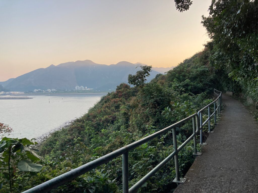
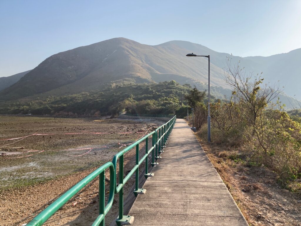
This pathway was somewhat narrow and hugged the coastline, offering a pleasant view of Tai O village and the promenade. Small birds flew over the ocean, adding to the scenic atmosphere. The road was relatively flat with some slight inclines and declines, but it was completely paved, making it easy to walk.
Some precautions should be taken: the road is narrow, so hikers need to be careful not to trip off the sides. Additionally, wildlife may be nearby, and it’s essential not to disturb them. As the path passes by some small houses, it’s important to remain quiet and respectful. Always remember to avoid littering.
D1 → D3 Tai O Bus Terminus to Sha Lo Wan Village Public Toilet
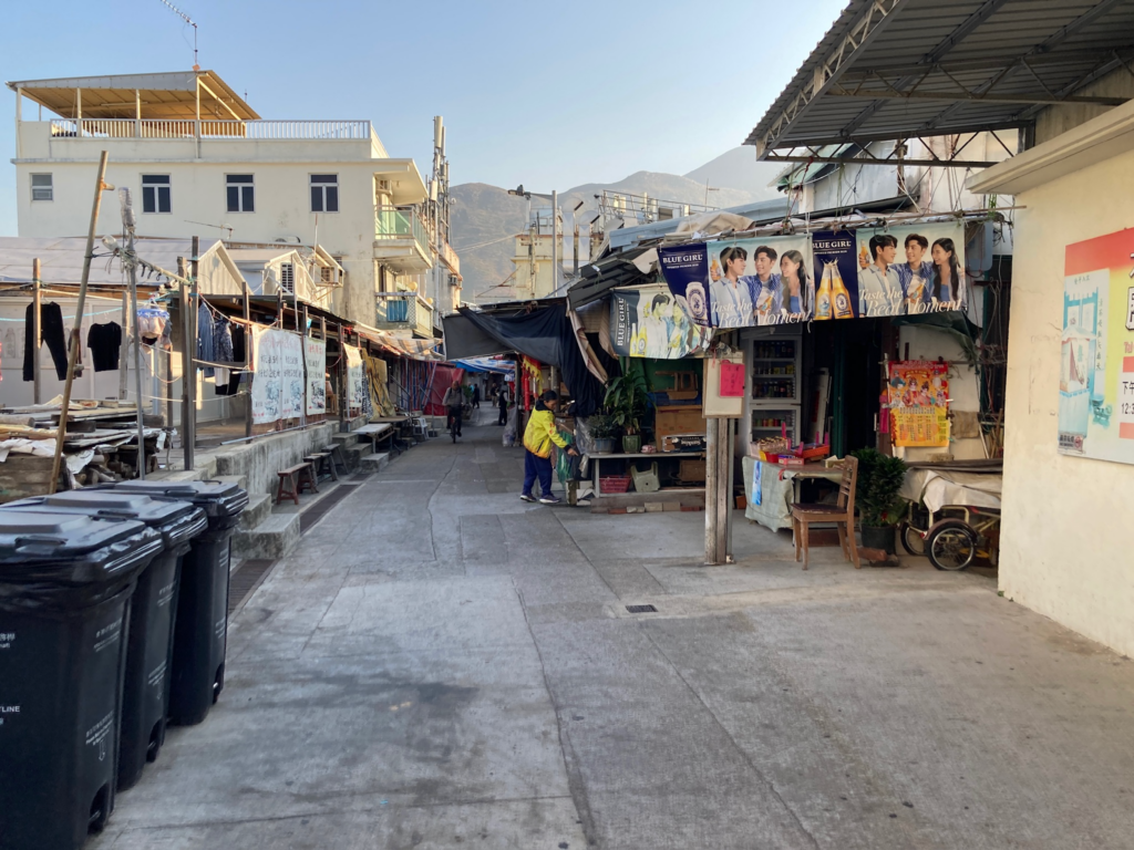
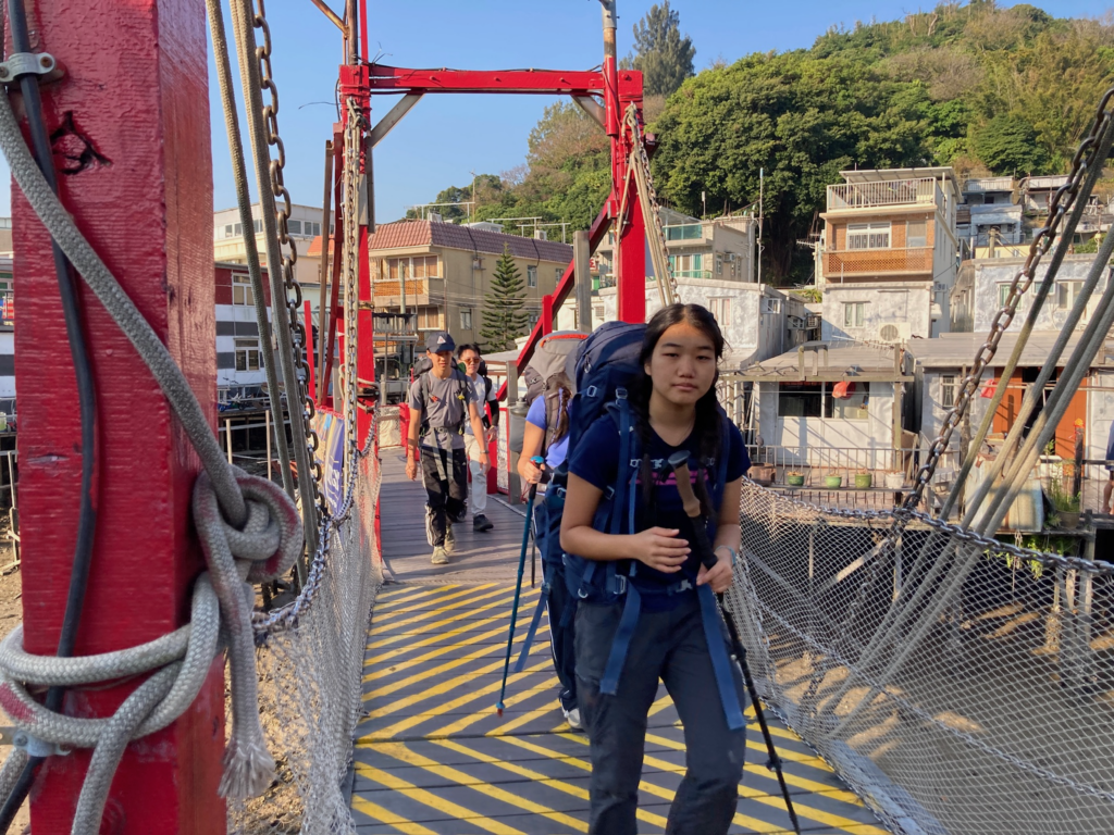
The initial section of the road was easy to walk but slightly challenging to navigate due to the need to go through Tai O Village. Hikers would need to maneuver through small streets and rely on village signs for direction rather than a physical map. It’s crucial to avoid disturbing the locals and not to touch anything or throw trash into the water. The Sun Ki bridge is a significant landmark and a scenic area, making it easy to identify.
From there onwards to Sha Lo Wan Village Public Toilet, the path was primarily flat, winding between the mountains with minor elevation changes, no higher than 80 meters. This path serves the villagers who live in small communities between Tai O and Tung Chung, providing access to Tung Chung. While traversing this path, it’s essential to remain quiet and respectful, especially in the morning or at night. If stopping to eat in one of the villages, ensure that you clean up after yourself.
North Lantau Obelisk
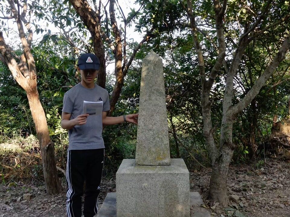
One of the interesting landmarks to see when visiting Tai O is the North Lantau Obelisk which was erected just northeast of the village. The small obelisk monument is located up a hillside just north of the Yim Tim Mangrove Forest. There are signs pointing the way and only a short ascent to climb. The monument is now situated in front of a few trees with the sea in the background. On its base is a worn and difficult to read engraving. Research reveals that it is reference to the Convention between the British and Qing governments recognising the extension of the Hong Kong territory, whereby the New Territories including Lantau Island was leased to Great Britain and fully under British administration in 1898. The monument was erected here four years later in 1902 by the British Navy.
The hike to the North Lantau Obelisk from Tai O is just a short walk, and there wasn’t any environmental damage along the way. However, there wasn’t any signage leading to the Obelisk, and it just appeared after a turn. The obelisk itself is still in relatively good condition, as it is still intact and well maintained even after over 100 years. However, the words etched onto the obelisk are starting to fade, and the words are now hard to read. One tip to improve the North Lantau Obelisk is to add more signage leading towards it, so that more people can stop by and understand the significance of it.
Tung O Ancient Trail
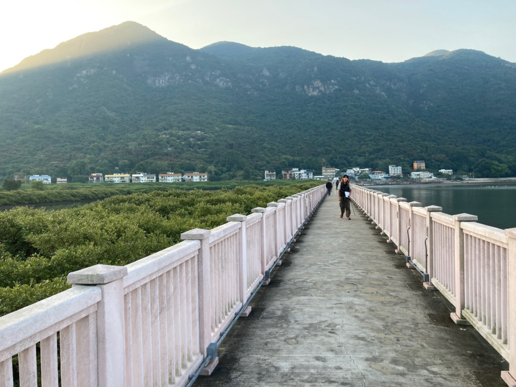
Tung O Ancient Trail is a 10km trail that old villagers use to commute from Tai O Village to the main city Tung Chung. It passes through various villages, including Sham Wat Village(深屈村), Sham Shek Village(深石村), Sha Lo Wan Village(深螺灣村), and San Tau Village(䃟頭村). This trail starts in Tai O and follows the coast, and ending just before it meets the highway at Tung Chung Road(東涌道)As this is mainly a coastal trail, it will pass through mangroves and bays, and you will also be able to observe the airport on the trail.
This trail consists of a paved road and is overall quite well maintained, and there was consistent signage along the way. However, the signage to the start point was not very clear, and as Tai O is quite a large village, it took us some time to navigate and ask the locals where to start. There was signage towards the start of the path, but not in the center of Tai O village itself. Furthermore, there was a lot of trash along the road, which may make the villagers mad as they use the road to commute to Tung Chung every day.
To improve this feature, the government should improve the visibility to the start point on both Tai O village and Tung Chung side. They should also promote this trail online to tourists, as well as include any famous stories of this trail along the way. This would make it more popular towards the tourists and give them an alternative and more scenic route to Tai O, which also reduces the overcrowding of the buses to Tai O.
Hong Kong International Airport
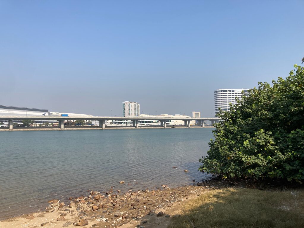
Hong Kong International Airport is situated on Chek Lap Kok Island, having replaced the iconic Kai Tak Airport due to overcapacity when it opened in 1998. At the time of its opening, it had the largest passenger terminal buildings and is currently the busiest cargo gateway. The airport hosts 100 airlines operating flights to over 180 cities, handling 68.5 million passengers annually, making it the 8th busiest airport worldwide by passenger traffic.
Covering an area of 4,700 acres, the airport features 89 boarding gates, including 77 jet bridge gates and 12 virtual gates (where passengers are ferried by buses). Of the 77 jet bridges, 5 are capable of accommodating the Airbus A380.
In the 2010s, the airport authority announced plans for development, estimating that the airport would reach its maximum capacity around 2020. A three-runway system was proposed to increase capacity from 420,000 flights per year to 620,000 flights per year (approximately 102 flights per hour, or one flight every 36 seconds), and cargo capacity from 6 million to 8.9 million tons by 2030.
Tung Chung Fort
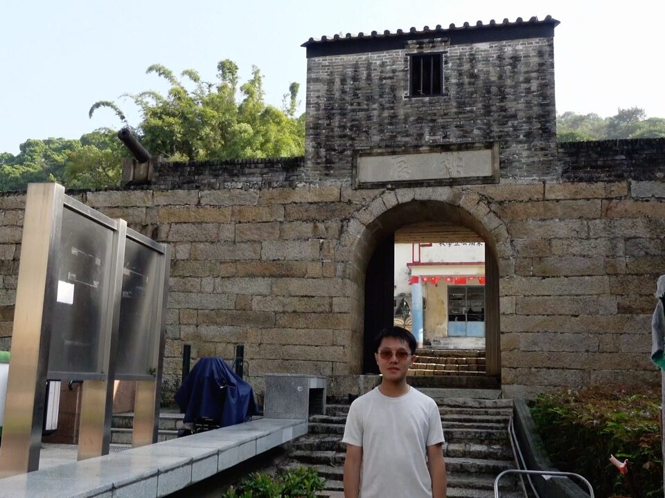
Tung Chung Fort was built during the Shun Hei era (1174 AD) in the Southern Song dynasty. Its original purpose was to combat smugglers transporting salt from Lantau Island to Canton City, who often attacked government workers. Consequently, 300 soldiers were stationed at Tung Chung to construct the fort. After three years of peace, the fort was left empty, and 150 soldiers were redeployed to the Kowloon Walled City.
During the Qing dynasty, the fort became a base for many pirates, including Cheung Po Tsai. In 1932, the fort was rebuilt and garrisoned to defend against pirates until the lease of the New Territories to Great Britain in 1898. After this period, the fort was abandoned. Today, six intact muzzle-loading cannons remain, each resting on a cement base. These mounts are likely for display purposes only, as they are not in a combat-ready configuration.
The condition of Tung Chung Fort is primarily of historical significance. The signage leading to the site was adequate, although its state suggests it is not a historically notable location associated with famous battles. To enhance the site, more attention should be given to renovations. This location, which once served as a fort, school, and community center, could benefit from displaying old photographs or artistic interpretations, showcasing its historical context. Removing any obstructing trees would also improve visibility from outside the fort.
D3 → EP Sha Lo Wan Village Public Toilet to Tung Chung Station
We departed from Sha Lo Wan public toilets feeling satisfied after a meal, determined to complete the last leg of our journey on time. This final stretch primarily involved finishing the Tung O Ancient Trail and hiking through Tung Chung to our destination at Tung Chung Station. The entire route was paved, and we passed several villages along the way. Fortunately for Jasper, who had a stomachache, there was a public toilet available during the hike!
Once we entered the city of Tung Chung, we crossed a few footbridges and subways before finding our way back to where we started four days earlier. We were finally done with our journey!
On this trail, it’s important to remain quiet as you pass through villages to avoid disturbing the residents. Additionally, keep your trash with you and do not use the villagers’ rubbish bins, as they rely on them for their own waste disposal. Instead, carry your trash until you reach Tung Chung, where you can dispose of it properly.
Conclusion
After reading this blog, we hope that you feel confident enough to try out this hiking trail with your group of friends. Remember to observe our conservation tips and follow the principles of Leave No Trace as you embark upon our hiking journey!